Centre de secours principal d’Abbeville
Centre de secours principal d’Abbeville is a fire station in Abbeville, Somme, Hauts-de-France. Centre de secours principal d’Abbeville is situated nearby to the marketplace Halle Jean-Pierre Pernault, as well as near Collegiate Church of Saint-Vulfran.| Tap on a place to explore it |
- Email: chef.abbeville@sdis80.fr
- Type: Fire station
- Also known as: “ABBEVILLE” and “CSP Abbeville”
Places of Interest Nearby
Highlights include Collegiate Church of Saint-Vulfran and Town hall of Abbeville.
Collegiate Church of Saint-Vulfran
Church

Photo: Camster2, CC BY-SA 3.0.
The Collegiate Church of Saint-Vulfran is a collegiate church located in Abbeville, France. The church, dedicated to Saint Vulfran is of Flamboyant Gothic style. Collegiate Church of Saint-Vulfran is situated 140 metres northwest of Centre de secours principal d’Abbeville.
Town hall of Abbeville
Town hall
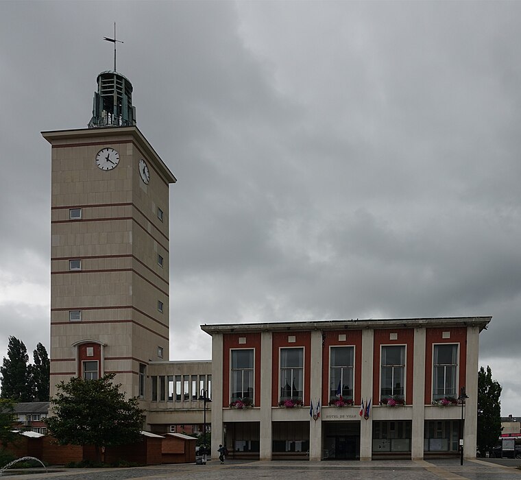
Photo: Gzen92, CC BY-SA 4.0.
Town hall of Abbeville is situated 250 metres north of Centre de secours principal d’Abbeville.
Musée Boucher-de-Perthes
Museum

Photo: Emmanuelhammel, CC BY-SA 3.0.
Musée Boucher-de-Perthes is a museum, which is situated 390 metres north of Centre de secours principal d’Abbeville.
Places in the Area
Nearby places include Saint-Riquier and Lamotte-Buleux.
Saint-Riquier
Village
 Saint-Riquier is a commune in the Somme department in Hauts-de-France in northern France. Saint-Riquier is situated 9 km northeast of Centre de secours principal d’Abbeville.
Lamotte-Buleux
Village

Photo: APictche, CC BY-SA 3.0.
Lamotte-Buleux is a commune in the Somme département in Hauts-de-France in northern France. Lamotte-Buleux is situated 9 km north of Centre de secours principal d’Abbeville.
Canchy
Village

Photo: Pymouss, CC BY-SA 3.0.
Canchy is a commune in the Somme department in Hauts-de-France in northern France. There was a station on the Réseau des Bains de Mer which opened on 19 June 1892 and closed on 10 March 1947. Canchy is situated 10 km north of Centre de secours principal d’Abbeville.
Centre de secours principal d’Abbeville
Latitude
50.10367° or 50° 6′ 13″ northLongitude
1.833° or 1° 49′ 59″ eastOpen location code
9F234R3M+F5OpenStreetMap ID
way 965390081OpenStreetMap feature
amenity=fire_station
This page is based on OpenStreetMap, Wikidata, and Wikimedia Commons.
We’d love your help improving our open data sources. Thank you for contributing.
Satellite Map
Discover Centre de secours principal d’Abbeville from above in high-definition satellite imagery.
Notable Places Nearby
Highlights include Halle Jean-Pierre Pernault and Chapelle de l’Hôtel-Dieu d’Abbeville.
Nearby Places
Explore places such as Chauss’expo and Crustum.
Hauts-de-France: Must-Visit Destinations
Delve into Lille, Dunkirk, Calais, and Amiens.
Curious Fire Stations to Discover
Uncover intriguing fire stations from every corner of the globe.
About Mapcarta. Data © OpenStreetMap contributors and available under the Open Database License". Text is available under the CC BY-SA 4.0 license, except for photos, directions, and the map. Photo: Pline, CC BY-SA 3.0.