Ruševine pravoslavnog hrama Svete Nedelje
Ruševine pravoslavnog hrama Svete Nedelje is a ruins in Town of Obrovac, Zadar County. Ruševine pravoslavnog hrama Svete Nedelje is situated nearby to the village Karin, as well as near the church crkva svete Male Terezije.| Tap on a place to explore it |
Places in the Area
Nearby places include Karin and Donji Karin.
Karin
Village
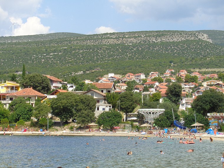
Photo: Silverije, CC BY-SA 4.0.
Gornji Karin is a settlement in the City of Obrovac in Croatia. In 2021, its population was 824.

Pridraga
Village

Photo: SpeedyGonsales, CC BY-SA 3.0.
Pridraga is a village in Dalmatia, Croatia, located southeast of Novigrad, Zadar County. The population is 1,470. Pridraga is situated 4½ km west of Ruševine pravoslavnog hrama Svete Nedelje.
Ruševine pravoslavnog hrama Svete Nedelje
- Type: Ruins
- Category: historic site
- Location: Town of Obrovac, Zadar County, Croatia, Balkans, Europe
- View on OpenStreetMap
Latitude
44.13159° or 44° 7′ 54″ northLongitude
15.63519° or 15° 38′ 7″ eastOpen location code
8FPQ4JJP+J3OpenStreetMap ID
way 965603506OpenStreetMap feature
historic=ruins
This page is based on OpenStreetMap, Wikidata, and Wikimedia Commons.
We’d love your help improving our open data sources. Thank you for contributing.
Satellite Map
Discover Ruševine pravoslavnog hrama Svete Nedelje from above in high-definition satellite imagery.
In Other Languages
“Ruševine pravoslavnog hrama Svete Nedelje” goes by many names.
- Serbian: “Рушевине православног храма Свете Недеље”
Notable Places Nearby
Highlights include 23452 Karin and crkva svete Male Terezije.
Nearby Places
Explore places such as Apartmani Milić and Apartmani Stela.
Croatia: Must-Visit Destinations
Delve into Zagreb, Dubrovnik, Split, and Rijeka.
Curious Ruins to Discover
Uncover intriguing ruins from every corner of the globe.
About Mapcarta. Data © OpenStreetMap contributors and available under the Open Database License". Text is available under the CC BY-SA 4.0 license, except for photos, directions, and the map. Photo: Wikimedia, CC BY-SA 3.0.