p
p is a grassland in Suffolk County, New York. p is situated nearby to the village Sagaponack, as well as near Peters Pond.| Tap on a place to explore it |
Places of Interest Nearby
Highlights include Bridgehampton station and Fair Field.
Bridgehampton station
Railway station

Photo: DanTD, CC BY-SA 4.0.
Bridgehampton is a station along the Montauk Branch of the Long Island Rail Road. It is located at Maple Lane and Butter Lane, in Bridgehampton, New York. Bridgehampton station is situated 2½ miles northwest of p.
Fair Field
Residential area
Fair Field is a large private house in Sagaponack, Long Island, in New York State in the United States. The main house is approximately 64,000 sq ft, and the total floor area is 110,000 sq ft, unless an exception is granted by the town's Zoning Board of Appeals. Fair Field is situated 1½ miles northeast of p.
Places in the Area
Nearby places include Sagaponack and Bridgehampton.
Sagaponack
Village

Photo: Americasroof, CC BY-SA 3.0.
Sagaponack is a village in the Town of Southampton in Suffolk County, on the East End of Long Island, in New York, United States. The population of the village was 770 at the 2020 census. Sagaponack is the second wealthiest zip code in the United States.
Bridgehampton
Town

Photo: Wikimedia, CC BY-SA 2.5.
Bridgehampton is a hamlet and census-designated place on the South Fork of Suffolk County, New York, United States. The population was 1,756 at the 2010 census. Bridgehampton is situated 2 miles north of p.
Wainscott
Village
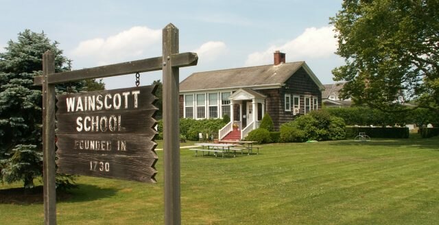
Photo: Americasroof, CC BY-SA 2.5.
Wainscott is a hamlet in the Town of East Hampton in Suffolk County, New York, United States, on the South Fork of Long Island. As of the 2010 United States census, the CDP population was 650. Wainscott is situated 3½ miles northeast of p.
p
- Type: Grassland
- Location: Suffolk County, New York, Mid-Atlantic, United States, North America
- View on OpenStreetMap
Latitude
40.90734° or 40° 54′ 26″ northLongitude
-72.29222° or 72° 17′ 32″ westOpen location code
87G9WP45+W4OpenStreetMap ID
way 967999104OpenStreetMap feature
natural=grassland
This page is based on OpenStreetMap, Wikidata, and Wikimedia Commons.
We’d love your help improving our open data sources. Thank you for contributing.
Satellite Map
Discover p from above in high-definition satellite imagery.
Notable Places Nearby
Highlights include Mecox Cemetery and Sagg Cemetery.
Nearby Places
Explore places such as i and Fairfield Pond.
Suffolk County: Must-Visit Destinations
Delve into Montauk, Huntington, Southampton, and Stony Brook.
Curious Grasslands to Discover
Uncover intriguing grasslands from every corner of the globe.
About Mapcarta. Data © OpenStreetMap contributors and available under the Open Database License". Text is available under the CC BY-SA 4.0 license, except for photos, directions, and the map. Photo: Wikimedia, CC0.