Sportplatz Friedrich-Ludwig-Jahn-Allee
Sportplatz Friedrich-Ludwig-Jahn-Allee is a stadium in Radeburg, Meissen, Saxony. Sportplatz Friedrich-Ludwig-Jahn-Allee is situated nearby to the sports venue Keller, as well as near the police station Polizeistandort Radeburg.| Tap on a place to explore it |
Places of Interest Nearby
Highlights include Polish-Saxon Post Milestone Radeburg and Kgl.-sächs. Postmeilenstein Radeburg.
Polish-Saxon Post Milestone Radeburg
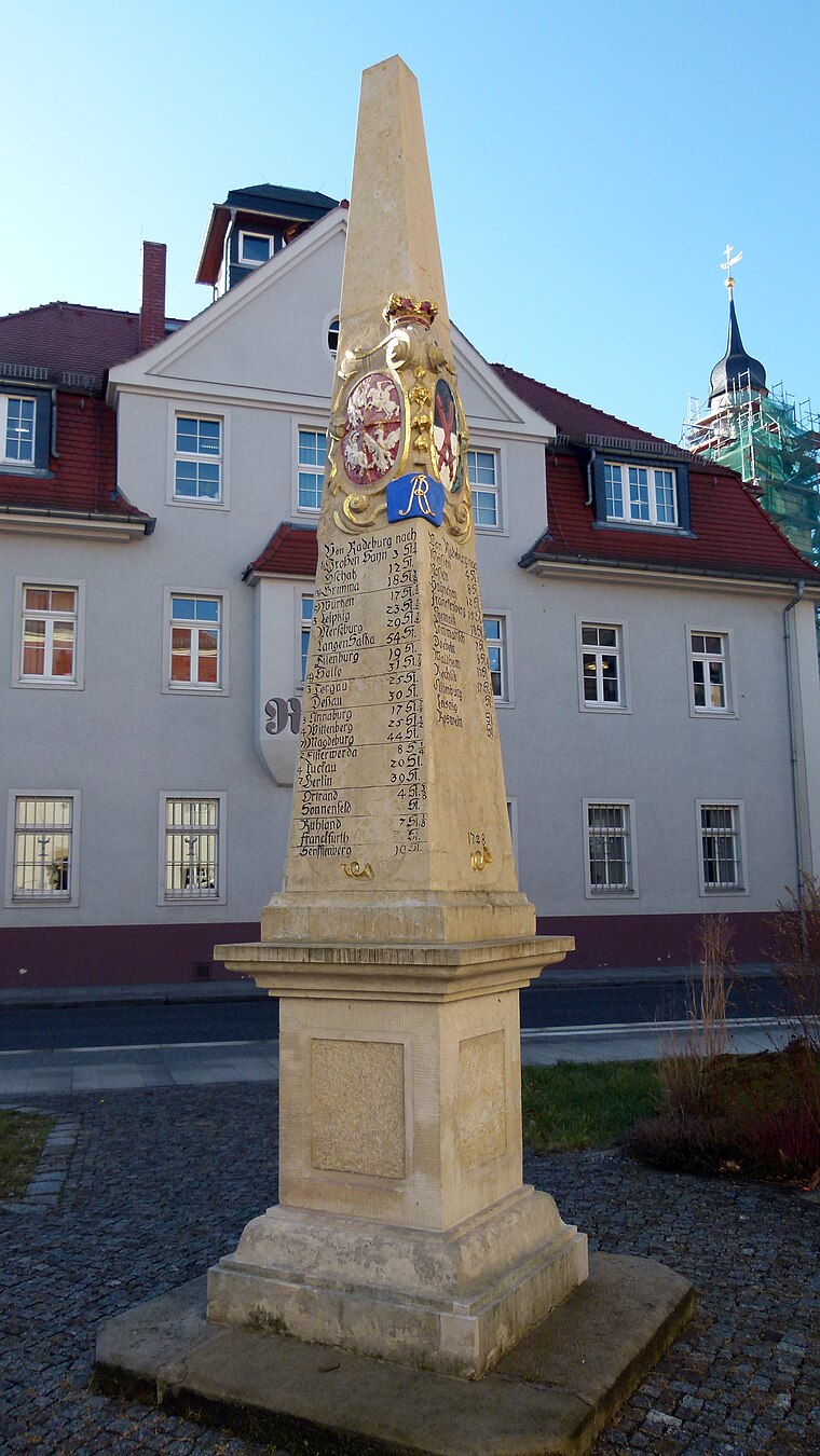
Photo: Dr. Bernd Gross, CC BY-SA 4.0.
Polish-Saxon Post Milestone Radeburg is situated 630 metres southwest of Sportplatz Friedrich-Ludwig-Jahn-Allee.
Kgl.-sächs. Postmeilenstein Radeburg
Historic site
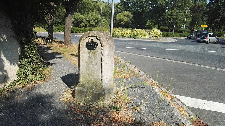
Photo: Z thomas, CC BY-SA 3.0.
Kgl.-sächs. Postmeilenstein Radeburg is a historic site, which is situated 1 km south of Sportplatz Friedrich-Ludwig-Jahn-Allee.
Heinrich-Zille-Denkmal
Memorial

Photo: Clemensfranz, CC BY-SA 4.0.
Heinrich-Zille-Denkmal is a memorial, which is situated 750 metres southwest of Sportplatz Friedrich-Ludwig-Jahn-Allee.
Places in the Area
Nearby places include Rödern and Berbisdorf.
Rödern
Village

Photo: Conny, CC BY-SA 3.0.
Rödern is a village, which is situated 2½ km northwest of Sportplatz Friedrich-Ludwig-Jahn-Allee.
Berbisdorf
Village

Photo: X-Weinzar, CC BY-SA 2.5.
Berbisdorf is a village, which is situated 3½ km south of Sportplatz Friedrich-Ludwig-Jahn-Allee.
Großdittmannsdorf
Village

Photo: BK1950, CC BY-SA 4.0.
Großdittmannsdorf is a village, which is situated 4 km southeast of Sportplatz Friedrich-Ludwig-Jahn-Allee.
Sportplatz Friedrich-Ludwig-Jahn-Allee
- Type: Stadium
- Categories: recreation area, tourist attraction, and tourism
- Location: Radeburg, Meissen, Saxony, Germany, Central Europe, Europe
- View on OpenStreetMap
Latitude
51.21961° or 51° 13′ 11″ northLongitude
13.73107° or 13° 43′ 52″ eastOpen location code
9F3M6P9J+RCOpenStreetMap ID
way 968523600OpenStreetMap feature
leisure=stadium
This page is based on OpenStreetMap, Wikidata, and Wikimedia Commons.
We’d love your help improving our open data sources. Thank you for contributing.
Satellite Map
Discover Sportplatz Friedrich-Ludwig-Jahn-Allee from above in high-definition satellite imagery.
Notable Places Nearby
Highlights include Keller and Polizeistandort Radeburg.
Nearby Places
Explore places such as Impfstelle TSV 1862 Radeburg e. V. and Keller - Crew.
Saxony: Must-Visit Destinations
Delve into Dresden, Leipzig, Chemnitz, and Meißen.
Curious Stadiums to Discover
Uncover intriguing stadiums from every corner of the globe.
About Mapcarta. Data © OpenStreetMap contributors and available under the Open Database License". Text is available under the CC BY-SA 4.0 license, except for photos, directions, and the map. Photo: Taxiarchos228, FAL.