Kläranlage Großpetersdorf
Kläranlage Großpetersdorf is a wastewater treatment plant in Großpetersdorf, Oberwart District, Burgenland. Kläranlage Großpetersdorf is situated nearby to the chapel Filialkirche Kleinzicken, as well as near Kleinzicken War Memorial.| Tap on a place to explore it |
Places of Interest Nearby
Highlights include Filialkirche Kleinzicken and Fire station in Kleinpetersdorf.
Filialkirche Kleinzicken
Chapel

Photo: Stefan Fadinger, CC BY-SA 4.0.
Filialkirche Kleinzicken is a chapel, which is situated 720 metres east of Kläranlage Großpetersdorf.
Fire station in Kleinpetersdorf
Fire station

Photo: Nxr-at, CC BY-SA 4.0.
Fire station in Kleinpetersdorf is situated 1 km northeast of Kläranlage Großpetersdorf.
Filialkirche Kleinpetersdorf
Church
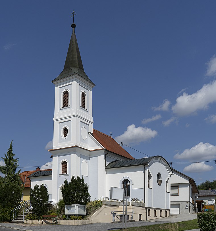
Photo: Stefan Fadinger, CC BY-SA 4.0.
Filialkirche Kleinpetersdorf is a church, which is situated 1 km northeast of Kläranlage Großpetersdorf.
Places in the Area
Nearby places include Kleinzicken and Kleinpetersdorf.


Kläranlage Großpetersdorf
- Type: Wastewater treatment plant
- Category: industry
- Location: Großpetersdorf, Oberwart District, Burgenland, Austria, Central Europe, Europe
- View on OpenStreetMap
Latitude
47.20788° or 47° 12′ 28″ northLongitude
16.3269° or 16° 19′ 37″ eastOpen location code
8FVR685G+5QOpenStreetMap ID
way 97253739OpenStreetMap feature
man_made=wastewater_plant
This page is based on OpenStreetMap, Wikidata, and Wikimedia Commons.
We’d love your help improving our open data sources. Thank you for contributing.
Satellite Map
Discover Kläranlage Großpetersdorf from above in high-definition satellite imagery.
Notable Places Nearby
Highlights include Kleinzicken War Memorial and Kleinpetersdorf War Memorial.
Nearby Places
Explore places such as Kleinzicken and Kleinpetersdorf Süd.
Burgenland: Must-Visit Destinations
Delve into Eisenstadt, Neusiedl am See, Rust, and Güssing.
Curious Wastewater Treatment Plants to Discover
Uncover intriguing wastewater treatment plants from every corner of the globe.
About Mapcarta. Data © OpenStreetMap contributors and available under the Open Database License". Text is available under the CC BY-SA 4.0 license, except for photos, directions, and the map. Photo: Wikimedia, CC BY-SA 4.0.