Baugebiet Nr. 43 - Sevelten
Baugebiet Nr. 43 - Sevelten is in Cappeln, Cloppenburg, Lower Saxony. Baugebiet Nr. 43 - Sevelten is situated nearby to Ferienhof von Hammel, as well as near the recreation area Grüner Pavillion.| Tap on a place to explore it |
Places of Interest Nearby
Highlights include Cloppenburg train station and St. Andreas.
Cloppenburg train station
Railway station
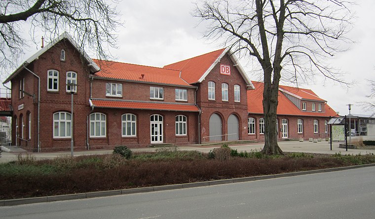
Photo: Corradox, CC BY-SA 4.0.
Cloppenburg train station is a railway station, which is situated 3½ km north of Baugebiet Nr. 43 - Sevelten.
St. Andreas
Church

Photo: Wikimedia, Copyrighted free use.
St. Andreas is a church, which is situated 3½ km north of Baugebiet Nr. 43 - Sevelten.
St. Augustinus
Church

Photo: Gerd Fahrenhorst, CC BY 4.0.
St. Augustinus is a church, which is situated 3½ km north of Baugebiet Nr. 43 - Sevelten.
Places in the Area
Nearby places include Cloppenburg and Bethen.
Cloppenburg
Town
Photo: Wikimedia, Copyrighted free use.
Cloppenburg is a town in Lower Saxony, in north-western Germany, capital of Cloppenburg District and part of Oldenburg Münsterland. It lies 38 km south-south-west of Oldenburg in the Weser-Ems region between Bremen and the Dutch border. Cloppenburg is situated 4 km north of Baugebiet Nr. 43 - Sevelten.
Bethen
Hamlet

Photo: Rabanus Flavus, Public domain.
Bethen is a small town on the edge of the German city Cloppenburg in Lower Saxony. It is a Marian shrine, as such first mentioned in 1448. Bethen is situated 6 km north of Baugebiet Nr. 43 - Sevelten.
Emstek
Village

Photo: Dirk urbansky, CC BY-SA 3.0.
Emstek is a municipality in the district of Cloppenburg, in Lower Saxony, Germany. It is situated approximately 8 km east of Cloppenburg. Emstek is situated 7 km east of Baugebiet Nr. 43 - Sevelten.
Baugebiet Nr. 43 - Sevelten
- Type: Construction
- Location: Cappeln, Cloppenburg, Lower Saxony, Germany, Central Europe, Europe
- View on OpenStreetMap
Latitude
52.8109° or 52° 48′ 39″ northLongitude
8.05322° or 8° 3′ 12″ eastOpen location code
9F4CR363+97OpenStreetMap ID
way 977391185OpenStreetMap feature
landuse=construction
This page is based on OpenStreetMap, Wikidata, and Wikimedia Commons.
We’d love your help improving our open data sources. Thank you for contributing.
Satellite Map
Discover Baugebiet Nr. 43 - Sevelten from above in high-definition satellite imagery.
Notable Places Nearby
Highlights include Ferienhof von Hammel and Grüner Pavillion.
Nearby Places
Explore places such as Beautyfeel and Sevelten West S1.
Lower Saxony: Must-Visit Destinations
Delve into Hanover, Göttingen, Brunswick, and Wolfsburg.
Curious Places to Discover
Uncover intriguing places from every corner of the globe.
About Mapcarta. Data © OpenStreetMap contributors and available under the Open Database License". Text is available under the CC BY-SA 4.0 license, except for photos, directions, and the map. Photo: Danapit, CC BY-SA 3.0.