Im Kniepe
Im Kniepe is a parking area in Hildesheim, Hanover Region, Lower Saxony. Im Kniepe is situated nearby to the peak Michaelishügel, as well as near St. Michael’s Church.| Tap on a place to explore it |
Places of Interest Nearby
Highlights include St. Michael’s Church and Magdalenengarten.
St. Michael’s Church
Church
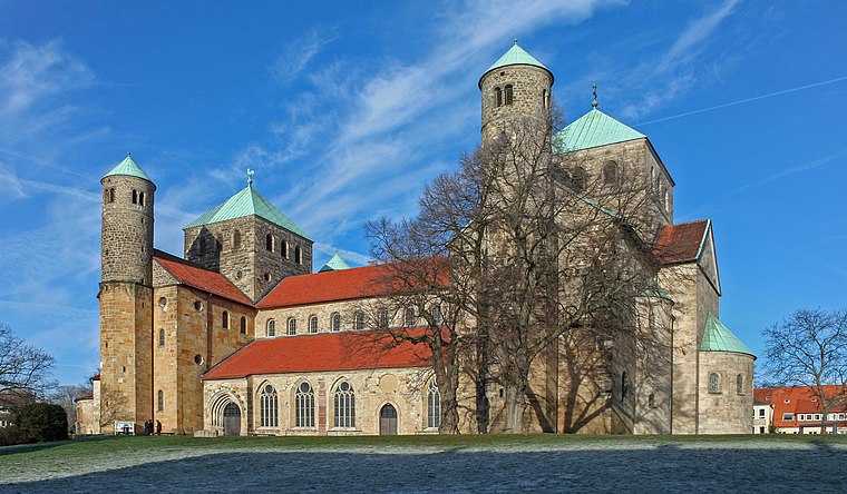
Photo: Heinz-Josef Lücking, CC BY-SA 3.0 de.
The Church of St. Michael is an early-Romanesque church located in Hildesheim, Germany. It has been on the UNESCO World Cultural Heritage list since 1985 due to the before mentioned early-Romanesque architecture and art found within such as the Tree of Jesse and the now relocated Bernward Doors. St. Michael’s Church is situated 130 metres southwest of Im Kniepe.
Magdalenengarten
Park

Photo: Torbenbrinker, CC BY-SA 3.0.
Magdalenengarten is a baroque park in Hildesheim in Lower Saxony, Germany. Magdalenengarten is situated 250 metres west of Im Kniepe.
Roemer- und Pelizaeus-Museum Hildesheim
Museum

Photo: Longbow4u, Public domain.
The Roemer- und Pelizaeus-Museum Hildesheim is an archaeological museum in Hildesheim, Germany. Mostly dedicated to ancient Egyptian and ancient Peruvian art, the museum also includes the second largest collection of Chinese porcelain in Europe. Roemer- und Pelizaeus-Museum Hildesheim is situated 480 metres south of Im Kniepe.
Places in the Area
Nearby places include Moritzberg and Sorsum.
Moritzberg
Neighborhood
Moritzberg is a quarter in the city of Hildesheim in Lower Saxony, Germany. It is on a hill in the west of the city, about a mile from the Cathedral. It was an independent market town until 1911.
Sorsum
Suburb
Sorsum, a district of the city of Hildesheim, is a small village in northern Germany. Sorsum is situated 4½ km west of Im Kniepe.
Barienrode
Village

Photo: Torbenbrinker, CC BY-SA 3.0.
Barienrode is a village, which is situated 4½ km south of Im Kniepe.
Im Kniepe
- Type: Parking area
- Parking: surface
- Category: transportation
- Location: Hildesheim, Hildesheim, Hanover Region, Lower Saxony, Germany, Central Europe, Europe
- View on OpenStreetMap
Latitude
52.15363° or 52° 9′ 13″ northLongitude
9.94473° or 9° 56′ 41″ eastOpen location code
9F4F5W3V+FVOpenStreetMap ID
way 97947021OpenStreetMap feature
amenity=parkingOpenStreetMap attribute
parking=surface
This page is based on OpenStreetMap, Wikidata, and Wikimedia Commons.
We’d love your help improving our open data sources. Thank you for contributing.
Satellite Map
Discover Im Kniepe from above in high-definition satellite imagery.
Notable Places Nearby
Highlights include Michaelishügel and Gymnasium Andreanum.
Nearby Places
Explore places such as Im Kniepe and Oberstufenhaus Gymnasium Andreanum.
Hanover Region: Must-Visit Destinations
Delve into Hanover, Nienburg, Verden an der Aller, and Alfeld.
Curious Parking Areas to Discover
Uncover intriguing parking areas from every corner of the globe.
About Mapcarta. Data © OpenStreetMap contributors and available under the Open Database License". Text is available under the CC BY-SA 4.0 license, except for photos, directions, and the map. Photo: Mey2008, CC BY-SA 3.0.