Střekovská vyhlídka
Střekovská vyhlídka is a scenic viewpoint in Ústí nad Labem, North Bohemia. Střekovská vyhlídka is situated nearby to the peak Sedlo, as well as near Church of Holy Trinity.| Tap on a place to explore it |
Places of Interest Nearby
Highlights include Church of Holy Trinity and Ústí nad Labem-Střekov railway station.
Church of Holy Trinity
Church

Photo: Wikimedia, Public domain.
Church of Holy Trinity is situated 260 metres southwest of Střekovská vyhlídka.
Ústí nad Labem-Střekov railway station
Railway station
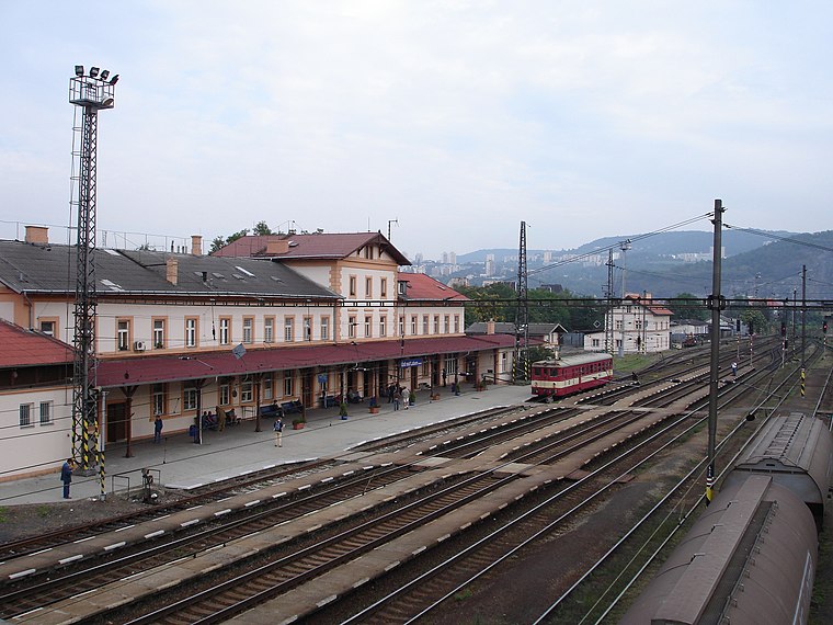
Photo: Rolf-Dresden, CC BY 2.5.
Ústí nad Labem-Střekov railway station is situated 1 km west of Střekovská vyhlídka.
Ústí nad Labem hlavní nádraží
Railway station

Photo: VitVit, CC BY-SA 4.0.
Ústí nad Labem hlavní nádraží is a railway station in Ústí nad Labem in the Ústí nad Labem Region of the Czech Republic. The station opened in 1850 and is located on the Praha–Ústí nad Labem–Děčín railway, Ústí nad Labem–Chomutov railway and Ústí nad Labem–Bílina railway. Ústí nad Labem hlavní nádraží is situated 1¼ km northwest of Střekovská vyhlídka.
Places in the Area
Nearby places include Střekov and Kojetice.


Střekovská vyhlídka
- Type: Scenic viewpoint
- Categories: tower, building, and tourism
- Location: Ústí nad Labem, Ústí nad Labem Region, North Bohemia, Czech Republic, Central Europe, Europe
- View on OpenStreetMap
Latitude
50.65253° or 50° 39′ 9″ northLongitude
14.06039° or 14° 3′ 37″ eastElevation
294 metres (965 feet)Height
12 metres (39 feet)Open location code
9F2PM336+25OpenStreetMap ID
way 982895932OpenStreetMap feature
building=yesOpenStreetMap feature
man_made=towerOpenStreetMap feature
tourism=viewpoint
This page is based on OpenStreetMap, Wikidata, and Wikimedia Commons.
We’d love your help improving our open data sources. Thank you for contributing.
Satellite Map
Discover Střekovská vyhlídka from above in high-definition satellite imagery.
Notable Places Nearby
Highlights include Sedlo and Ústí nad Labem 6.
Nearby Places
Explore places such as Střekovská vyhlídka and Pod vyhlídkou.
North Bohemia: Must-Visit Destinations
Delve into Liberec, Teplice, Děčín, and Bohemian Paradise.
Curious Scenic Viewpoints to Discover
Uncover intriguing scenic viewpoints from every corner of the globe.
About Mapcarta. Data © OpenStreetMap contributors and available under the Open Database License". Text is available under the CC BY-SA 4.0 license, except for photos, directions, and the map. Photo: Faigl.ladislav, CC BY-SA 3.0.