ehemalige Kindertagesstätte Regenbogenland
ehemalige Kindertagesstätte Regenbogenland is in Darmstadt, Wissenschaftsstadt, Darmstadt, Hesse. ehemalige Kindertagesstätte Regenbogenland is situated nearby to the outdoor gym Slackline, as well as near the fountain Drei ineinander verschlungene Ellipsen.| Tap on a place to explore it |
Places of Interest Nearby
Highlights include Darmstadt Central Station and Kunsthalle Darmstadt.
Darmstadt Central Station
Railway station
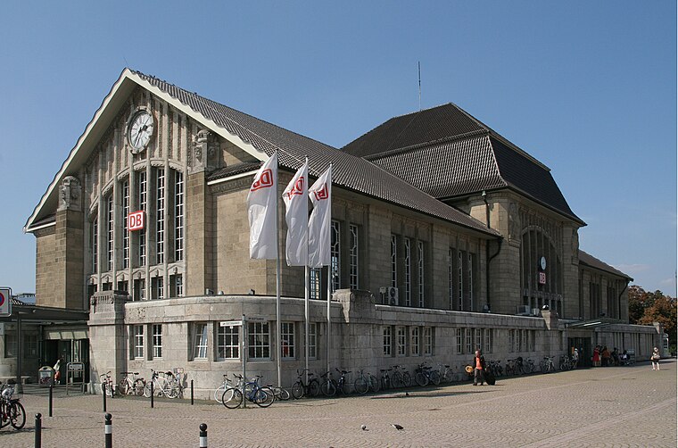
Photo: Mauritsvink, Public domain.
Darmstadt Hauptbahnhof is the main railway station in the German city Darmstadt. After Frankfurt Hbf and Wiesbaden Hbf, it is the third largest station in the state of Hesse with 35,000 passengers and 220 trains per day. Darmstadt Central Station is situated 750 metres northwest of ehemalige Kindertagesstätte Regenbogenland.
Kunsthalle Darmstadt
Arts center

Photo: Erkaha, CC BY-SA 4.0.
Kunsthalle Darmstadt is an arts center, which is situated 560 metres northeast of ehemalige Kindertagesstätte Regenbogenland.
Landgraf-Phillipps-Anlage
Park

Photo: Erkaha, CC BY-SA 4.0.
Landgraf-Phillipps-Anlage is a park, which is situated 450 metres northeast of ehemalige Kindertagesstätte Regenbogenland.
Places in the Area
Nearby places include Steubenplatz and Bessungen.

Bessungen
Quarter

Photo: Wikimedia, CC BY-SA 3.0.
Bessungen is a district in the South of the city of Darmstadt in Hesse.
Riedbahn
Suburb

Photo: Bjoertvedt, CC BY-SA 4.0.
Riedbahn is a suburb, which is situated 3 km northwest of ehemalige Kindertagesstätte Regenbogenland.
ehemalige Kindertagesstätte Regenbogenland
- Type: Construction
- Location: Darmstadt, Wissenschaftsstadt, Darmstadt, South Hesse, Hesse, Germany, Central Europe, Europe
- View on OpenStreetMap
Latitude
49.86818° or 49° 52′ 6″ northLongitude
8.63689° or 8° 38′ 13″ eastOpen location code
8FXCVJ9P+7QOpenStreetMap ID
way 987450776OpenStreetMap feature
landuse=construction
This page is based on OpenStreetMap, Wikidata, and Wikimedia Commons.
We’d love your help improving our open data sources. Thank you for contributing.
Satellite Map
Discover ehemalige Kindertagesstätte Regenbogenland from above in high-definition satellite imagery.
Notable Places Nearby
Highlights include Slackline and Drei ineinander verschlungene Ellipsen.
Nearby Places
Explore places such as Parkplatz Exlibris and Exlibris-Haus.
South Hesse: Must-Visit Destinations
Delve into Bensheim, Lorsch, Heppenheim, and Dreieich.
Curious Places to Discover
Uncover intriguing places from every corner of the globe.
About Mapcarta. Data © OpenStreetMap contributors and available under the Open Database License". Text is available under the CC BY-SA 4.0 license, except for photos, directions, and the map. Photo: Inkey, Public domain.