Projet Parc de Fontbelleau
Projet Parc de Fontbelleau is in Lormont, Arrondissement of Bordeaux, Nouvelle-Aquitaine. Projet Parc de Fontbelleau is situated nearby to Avenue de Paris, as well as near the power station Chaufferie de Lormont.| Tap on a place to explore it |
Places of Interest Nearby
Highlights include Château de Lormont and Pont d’Aquitaine.
Château de Lormont
Castle

Photo: Cenis, CC BY-SA 3.0.
The Château de Lormont, also known as the Château des Archevêques or the Château du Prince Noir, is a château in Lormont, Gironde, Nouvelle-Aquitaine, France. Château de Lormont is situated 1½ km west of Projet Parc de Fontbelleau.
Pont d’Aquitaine
Bridge

Photo: Geoffroy Groult, CC BY 2.0.
The Pont d'Aquitaine is a large suspension bridge over the Garonne, north-west of the city of Bordeaux, in France. It forms part of the ring-road of Bordeaux and carries the A630 autoroute. Pont d’Aquitaine is situated 2 km west of Projet Parc de Fontbelleau.
Jacques Chaban-Delmas Bridge
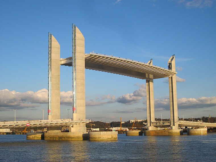
Photo: Prométhée33, CC BY-SA 3.0.
The Pont Jacques Chaban-Delmas is a vertical-lift bridge over the Garonne in Bordeaux, France. It was inaugurated on 16 March 2013 by President François Hollande and Alain Juppé, mayor of Bordeaux. Jacques Chaban-Delmas Bridge is situated 4 km southwest of Projet Parc de Fontbelleau.
Places in the Area
Nearby places include Bassens and Tresses.
Bassens
Village

Photo: Wikimedia, Public domain.
Bassens is a commune in the Gironde department in southwestern France. Bassens is situated 3 km north of Projet Parc de Fontbelleau.
Tresses
Village

Photo: Wikimedia, Public domain.
Tresses is a commune in the Gironde department in Nouvelle-Aquitaine in southwestern France. Tresses is situated 4½ km southeast of Projet Parc de Fontbelleau.
Floirac
Town

Photo: BlueGinkgo, CC BY-SA 3.0.
Floirac is a commune in the department of Gironde, New Aquitaine, southwestern France. Floirac is situated 5 km south of Projet Parc de Fontbelleau.
Projet Parc de Fontbelleau
- Type: Construction
- Location: Lormont, Arrondissement of Bordeaux, Gironde, Nouvelle-Aquitaine, France, Europe
- View on OpenStreetMap
Latitude
44.87494° or 44° 52′ 30″ northLongitude
-0.50932° or 0° 30′ 34″ westOperator
Cogedim - FradinOpen location code
8CPXVFFR+X7OpenStreetMap ID
way 996085298OpenStreetMap feature
landuse=construction
This page is based on OpenStreetMap, Wikidata, and Wikimedia Commons.
We’d love your help improving our open data sources. Thank you for contributing.
Satellite Map
Discover Projet Parc de Fontbelleau from above in high-definition satellite imagery.
Notable Places Nearby
Highlights include Avenue de Paris and Chaufferie de Lormont.
Nearby Places
Explore places such as Bâtiment C and Résidence Les Parisiennes.
Gironde: Must-Visit Destinations
Delve into Bordeaux, Arcachon, Saint-Émilion, and Soulac-sur-Mer.
Curious Places to Discover
Uncover intriguing places from every corner of the globe.
About Mapcarta. Data © OpenStreetMap contributors and available under the Open Database License". Text is available under the CC BY-SA 4.0 license, except for photos, directions, and the map. Photo: JLPC, CC BY-SA 3.0.