Pingo Doce
Pingo Doce is a supermarket in Almancil, Loulé, Faro District. Pingo Doce is situated nearby to the movie theater Cinema NOS, as well as near the shopping center Mar Shopping Algarve.| Tap on a place to explore it |
Places of Interest Nearby
Highlights include Estádio Algarve and Almancil-Nexe Halt.
Estádio Algarve
Stadium
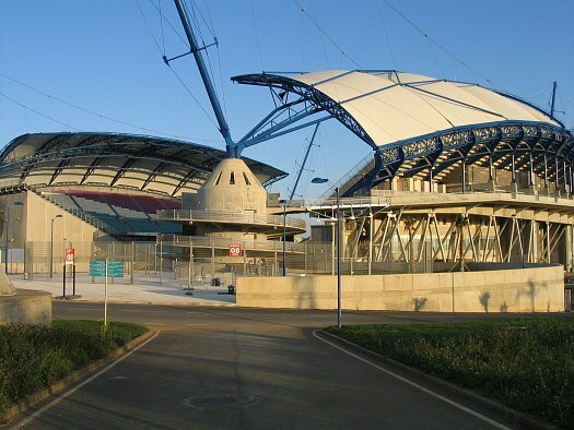
Photo: Wikimedia, CC BY-SA 2.0.
The Estádio Algarve is an association football stadium located between Faro and Loulé municipalities, in the Algarve region of Portugal. The stadium has a total capacity of 30,305 spectators and was purposely built for the UEFA Euro 2004 championship. Estádio Algarve is situated 2½ km southeast of Pingo Doce.
Almancil-Nexe Halt
Railway station

Photo: Jipeman, CC BY-SA 4.0.
Almancil-Nexe Halt is a railway station, which is situated 1½ km southeast of Pingo Doce.
Parque das Cidades train station
Railway station

Photo: Ajpvalente, CC BY 3.0.
Parque das Cidades train station is a railway station, which is situated 2½ km southeast of Pingo Doce.
Places in the Area
Nearby places include Santa Bárbara de Nexe and Quarteira.
Santa Bárbara de Nexe
Village
Santa Bárbara de Nexe is a village and civil parish in the Portuguese municipality of Faro on the southern Algarve region. The population in 2011 was 4,116, in an area of 38.22 km². It is located a few kilometers from both the cities of Loulé and Faro. Santa Bárbara de Nexe is situated 3 km east of Pingo Doce.
Quarteira

Photo: Creative Commons, CC BY-SA 4.0.
Quarteira is a Portuguese civil parish, in the municipality of Loulé in the Algarve. The population in 2011 was 21,798, in an area of 38.16 km².
Pingo Doce
- Type: Supermarket
- Postal code: 8135-182
- Categories: shop and food
- Location: Almancil, Loulé, Faro District, Algarve, Portugal, Iberia, Europe
- View on OpenStreetMap
Latitude
37.09913° or 37° 5′ 57″ northLongitude
-7.99707° or 7° 59′ 50″ westBranch
Loulé Mar ShoppingBrand
Pingo DoceOpen location code
8C9J32X3+M5OpenStreetMap ID
way 996150030OpenStreetMap feature
shop=supermarket
This page is based on OpenStreetMap, Wikidata, and Wikimedia Commons.
We’d love your help improving our open data sources. Thank you for contributing.
Satellite Map
Discover Pingo Doce from above in high-definition satellite imagery.
Places with the Same Name
Discover other places named “Pingo Doce”.
Notable Places Nearby
Highlights include Cinema NOS and Mar Shopping Algarve.
Nearby Places
Explore places such as Worten and BPI.
Algarve: Must-Visit Destinations
Delve into Faro, Portimão, Lagos, and Tavira.
Curious Supermarkets to Discover
Uncover intriguing supermarkets from every corner of the globe.
About Mapcarta. Data © OpenStreetMap contributors and available under the Open Database License". Text is available under the CC BY-SA 4.0 license, except for photos, directions, and the map. Photo: Michael Gaylard, CC BY 2.0.