Umspannstationen Schnellin
Umspannstationen Schnellin is an electrical substation in Bad Schmiedeberg, Wittenberg, Saxony-Anhalt. Umspannstationen Schnellin is situated nearby to the forest Eich Busch, as well as near the village Österitz.| Tap on a place to explore it |
Places of Interest Nearby
Highlights include Protestant church Rackith and Protestant church Globig.
Protestant church Rackith
Church
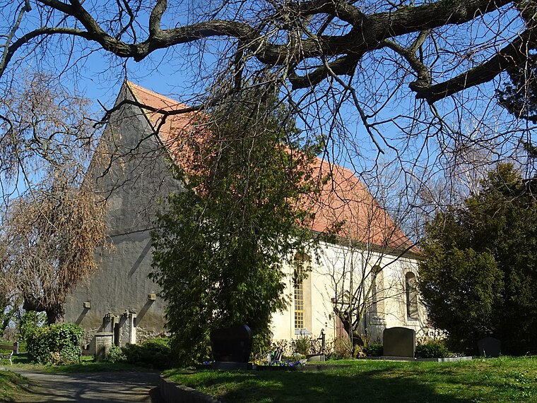
Photo: Global Fish, CC BY-SA 4.0.
Protestant church Rackith is situated 4 km north of Umspannstationen Schnellin.
Protestant church Globig
Church
 Protestant church Globig is situated 3½ km northeast of Umspannstationen Schnellin.
Places in the Area
Nearby places include Österitz and Kemberg.
Österitz
Village

Photo: Wolkenkratzer, CC BY-SA 4.0.
Österitz is a village, which is situated 4 km south of Umspannstationen Schnellin.
Kemberg
Town

Photo: Jwaller, CC BY-SA 3.0.
Kemberg is a town in Wittenberg district in Saxony-Anhalt, Germany. The town lies on the north edge of the Düben Heath Nature Park. Kemberg is situated 4½ km west of Umspannstationen Schnellin.

Umspannstationen Schnellin
- Type: Electrical substation
- Address: Dorna, Kemberg, 06901
- Category: industry
- Location: Bad Schmiedeberg, Wittenberg, Saxony-Anhalt, Germany, Central Europe, Europe
- View on OpenStreetMap
Latitude
51.77201° or 51° 46′ 19″ northLongitude
12.70057° or 12° 42′ 2″ eastOpen location code
9F3JQPC2+R6OpenStreetMap ID
way 996253737
This page is based on OpenStreetMap, Wikidata, and Wikimedia Commons.
We’d love your help improving our open data sources. Thank you for contributing.
Satellite Map
Discover Umspannstationen Schnellin from above in high-definition satellite imagery.
Notable Places Nearby
Highlights include Freiwillige Feuerwehr Schnellin and Sportplatz.
Nearby Places
Explore places such as 66290 and 66300.
Saxony-Anhalt: Must-Visit Destinations
Delve into Magdeburg, Halle, Wittenberg, and Quedlinburg.
Curious Electrical Substations to Discover
Uncover intriguing electrical substations from every corner of the globe.
About Mapcarta. Data © OpenStreetMap contributors and available under the Open Database License". Text is available under the CC BY-SA 4.0 license, except for photos, directions, and the map. Photo: GMM, Public domain.