Gaugrehweiler
Gaugrehweiler é um município da Alemanha localizado no distrito de Donnersbergkreis, na associação municipal de Verbandsgemeinde Alsenz-Obermoschel, no estado da Renânia-Palatinado.| Toque num local para o explorar |
Foto: Wikimedia, Public domain.
Locais de interesse
Os destaques incluem Pfälzisches Steinhauermuseum e Alsenz.
Pfälzisches Steinhauermuseum
museu
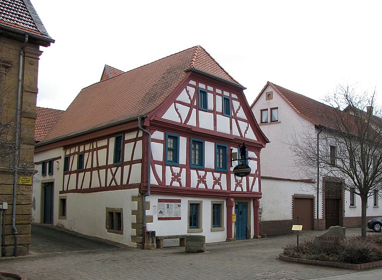
Foto: Traveler100, CC BY-SA 3.0.
Pfälzisches Steinhauermuseum encontra-se a 4 km a noroeste de Gaugrehweiler.
Alsenz
estação ferroviária

Foto: AK-Bino, CC BY-SA 4.0.
Alsenz é uma estação ferroviária, que encontra-se a 4 km a noroeste de Gaugrehweiler.
Evangelische Pfarrkirche
igreja

Foto: Solumno, CC BY-SA 4.0.
Evangelische Pfarrkirche é uma igreja, que encontra-se a 4 km a leste de Gaugrehweiler.
Locais na área
Os locais próximos incluem Alsenz e Sankt Alban.
Alsenz
aldeia
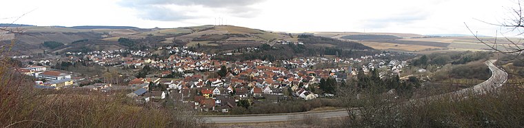
Foto: Traveler100, CC BY-SA 3.0.
Alsenz é um município da Alemanha, sede da associação municipal de Verbandsgemeinde Alsenz-Obermoschel, localizado no distrito de Donnersbergkreis, estado de Renânia-Palatinado. Alsenz encontra-se a 4 km a noroeste de Gaugrehweiler.
Sankt Alban
aldeia
Sankt Alban é um município da Alemanha localizado no distrito de Donnersbergkreis, na associação municipal de Verbandsgemeinde Rockenhausen, no estado da Renânia-Palatinado.
Oberhausen an der Appel
aldeia
Oberhausen an der Appel é um município da Alemanha localizado no distrito de Donnersbergkreis, na associação municipal de Verbandsgemeinde Alsenz-Obermoschel, no estado da Renânia-Palatinado.
Gaugrehweiler
- Tipo: aldeia com 552 habitantes
- Também conhecido como: «07333023»
- Categoria: localidade
- Localização: Donnersbergkreis, Renânia-Palatinado, Alemanha, Europa Central, Europa
- Ver no OpenStreetMap
Latitude
49,7064° ou 49° 42′ 23″ norteLongitude
7,8629° ou 7° 51′ 46″ lestePopulação
552Elevação
266 metros (873 pés)Open location code
8FX9PV47+H4OpenStreetMap ID
node 240044051Característica OpenStreetMap
place=villageGeoNames ID
6554946Wikidata ID
Q642168
Esta página é baseada no OpenStreetMap, GeoNames, Wikidata, Wikimedia Commons e Wikipédia.
Gostaríamos de contar com o seu apoio para melhorar as nossas fontes de dados abertas. Agradecemos a sua contribuição.
Mapa de satélite
Descubra Gaugrehweiler de cima na vista de satélite de alta definição.
Noutros idiomas
Do Africâner ao Zulu — «Gaugrehweiler» tem muitos nomes.
- Africâner: «Gaugrehweiler»
- Alemão: «Gaugrehweiler»
- Alemão: «Untergrehweiler»
- Aragonês: «Gaugrehweiler»
- Basco: «Gaugrehweiler»
- Bokmål norueguês: «Gaugrehweiler»
- Bretão: «Gaugrehweiler»
- Catalão: «Gaugrehweiler»
- cha: «Гаугревайлер»
- Chinês: «Gaugrehweiler»
- Chinês: «高格雷韦勒»
- Chinês: «高格雷魏莱尔»
- Chinês: «高格雷魏萊爾»
- Congolês: «Gaugrehweiler»
- Córso: «Gaugrehweiler»
- Croata: «Gaugrehweiler»
- Curdo: «Gaugrehweiler»
- Dinamarquês: «Gaugrehweiler»
- Eslovaco: «Gaugrehweiler»
- Esloveno: «Gaugrehweiler»
- Espanhol: «Gaugrehweiler»
- Esperanto: «Gaugrehweiler»
- Estoniano: «Gaugrehweiler»
- Finlandês: «Gaugrehweiler»
- Francês: «Gaugrehweiler»
- Gaélico: «Gaugrehweiler»
- Galego: «Gaugrehweiler»
- Galês: «Gaugrehweiler»
- Holandês: «Gaugrehweiler»
- hrv: «Gaugrehweiler»
- Húngaro: «Gaugrehweiler»
- Ido: «Gaugrehweiler»
- Indonésio: «Gaugrehweiler»
- Inglês: «Gaugrehweiler»
- Interlíngua: «Gaugrehweiler»
- Interlingue: «Gaugrehweiler»
- Irlandês: «Gaugrehweiler»
- Islandês: «Gaugrehweiler»
- Italiano: «Gaugrehweiler»
- Japonês: «ガウグレーヴァイラー»
- Limburguês: «Gaugrehweiler»
- Luxemburguês: «Gaugrehweiler»
- Malaio: «Gaugrehweiler»
- Malgaxe: «Gaugrehweiler»
- Norueguês Nynorsk: «Gaugrehweiler»
- Ossétio: «Gaugrehweiler»
- Persa: «گاوگرهوایلر»
- Polonês: «Gaugrehweiler»
- Romanche: «Gaugrehweiler»
- Romeno: «Gaugrehweiler»
- Russo: «Гаугревайлер»
- Sardo: «Gaugrehweiler»
- Sérvio: «Gaugrehvajler»
- Sérvio: «Gaugrehweiler»
- Sérvio: «Гаугрехвајлер»
- Suaíli: «Gaugrehweiler»
- Sueco: «Gaugrehweiler»
- Tatar: «Гаугревайлер»
- Turco: «Gaugrehweiler»
- Ucraniano: «Гаугревайлер»
- Uzbeque: «Gaugrehweiler»
- Uzbeque: «Gaugrevayler»
- Uzbeque: «Гаугревайлер»
- Uzbeque: «Гаугреҳwеилер»
- Valão: «Gaugrehweiler»
- Vietnamita: «Gaugrehweiler»
- Volapük: «Gaugrehweiler»
- Wolof: «Gaugrehweiler»
- Zulu: «Gaugrehweiler»
- «Gaugrehweiler»
Localidades na área
Explore destinos como Leiningerhof e Gutenbacherhof.
Locais notáveis nas proximidades
Os destaques incluem Freiwillige Feuerwehr Gaugrehweiler e Schloßberghalle.
Renânia-Palatinado: Destinos em destaque
Saiba mais sobre Mainz, Tréveris, Coblença e Worms.
Locais curiosos por descobrir
Conheça lugares fascinantes em cada canto do mundo.
Sobre o Mapcarta. Os dados © os contribuidores do OpenStreetMap e disponíveis sob a licença Open Database. O texto está disponível sob a licença CC BY-SA 4.0, exceto as fotos, as direções e o mapa. O texto da descrição é baseado na página Wikipédia «Gaugrehweiler». Foto: Wikimedia, Public domain.