Vlak Pan
Vlak Pan is a farm in Siyancuma Local Municipality, Pixley ka Seme District Municipality, Northern Cape and has an elevation of 1,039 metres. Vlak Pan is situated nearby to the hamlet Kalk Dam.| Tap on a place to explore it |
Places in the Area
Nearby places include Douglas.
Douglas
Town
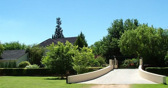
Photo: Wikimedia, CC BY-SA 3.0.
Douglas is an agricultural and stock farming town situated near the confluence of the Orange and Vaal rivers in the Northern Cape province of South Africa. Douglas is situated 9 km southeast of Vlak Pan.
Vlak Pan
- Type: Farm
- Category: agriculture
- Location: Siyancuma Local Municipality, Pixley ka Seme District Municipality, Northern Cape, South Africa, Southern Africa, Africa
- View on OpenStreetMap
Latitude
-28.98529° or 28° 59′ 7″ southLongitude
23.74016° or 23° 44′ 25″ eastElevation
1,039 metres (3,409 feet)Open location code
5G352P7R+V3GeoNames ID
943503
This page is based on GeoNames, Wikidata, and Wikimedia Commons.
We’d love your help improving our open data sources. Thank you for contributing.
Satellite Map
Discover Vlak Pan from above in high-definition satellite imagery.
Places with the Same Name
Discover other places named “Vlak Pan”.
Localities in the Area
Explore places such as Kalk Dam and Bucklands.
Notable Places Nearby
Highlights include Rooikoppies and Kolbergkop.
Northern Cape: Must-Visit Destinations
Delve into Kimberley, Orania, Upington, and Kuruman.
Curious Farms to Discover
Uncover intriguing farms from every corner of the globe.
About Mapcarta. Text is available under the CC BY-SA 4.0 license, except for photos, directions, and the map. Photo: Amrum, CC BY 3.0.