Río Claro
Río Claro is a stream in Caldas Department, Colombia and has an elevation of 1,535 metres. Río Claro is situated nearby to the hamlet Llanitos, as well as near La Violeta.| Tap on a place to explore it |
Places in the Area
Nearby places include Villamaría and Chinchiná.
Villamaría
Town

Photo: David.orozco94, CC BY 3.0.
Villamaría is a town and municipality in the Colombian Department of Caldas. Located in the Colombian coffee growing axis, it was made part of the "Coffee Cultural Landscape" UNESCO World Heritage Site in 2011. Villamaría is situated 6 km northeast of Río Claro.
Chinchiná
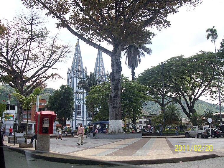
Photo: Azsxdcfvgbhnjm, CC BY 3.0.
Chinchiná, a town in the Zona Cafetera, is known as the heart of Colombian coffee. It is settled in a valley surrounded by coffee plantations. The town is home to the Buendia coffee factory and Cenicafe, a coffee research centre.
Palestina
Town

Photo: XalD, CC BY-SA 4.0.
Palestina is a town in the south central region of the state of Caldas, Colombia. Located in the Triangle of Coffee Area, with a culture and tradition related to the colonization of Antioquia and the coffee growing. Palestina is situated 8 km west of Río Claro.
Río Claro
- Type: Stream
- Also known as: “Rio Claro”
- Category: body of water
- Location: Caldas Department, Colombia, South America
- View on OpenStreetMap
Latitude
5° northLongitude
-75.55° or 75° 33′ westElevation
1,535 metres (5,036 feet)Open location code
67Q62F22+22GeoNames ID
3686204
This page is based on GeoNames, Wikidata, and Wikimedia Commons.
We’d love your help improving our open data sources. Thank you for contributing.
Satellite Map
Discover Río Claro from above in high-definition satellite imagery.
Places with the Same Name
Discover other places named “Río Claro”.
Localities in the Area
Explore places such as Ríoclaro and Llanitos.
Notable Places Nearby
Highlights include Alto de La Cruz and Alto de Santo Domingo.
Colombia: Must-Visit Destinations
Delve into Bogotá, Medellín, Cali, and Cartagena.
Curious Places to Discover
Uncover intriguing places from every corner of the globe.
About Mapcarta. Text is available under the CC BY-SA 4.0 license, except for photos, directions, and the map. Photo: jhoudayer, CC BY-SA 2.0.