San Rafael
San Rafael is a neighborhood in Cárdenas Municipality, Táchira and has an elevation of 1,241 metres. San Rafael is situated nearby to the village El Junco, as well as near El Llanito.| Tap on a place to explore it |
Places of Interest
Highlights include San Cristóbal Paramillo Airport.
San Cristóbal Paramillo Airport
Aerodrome
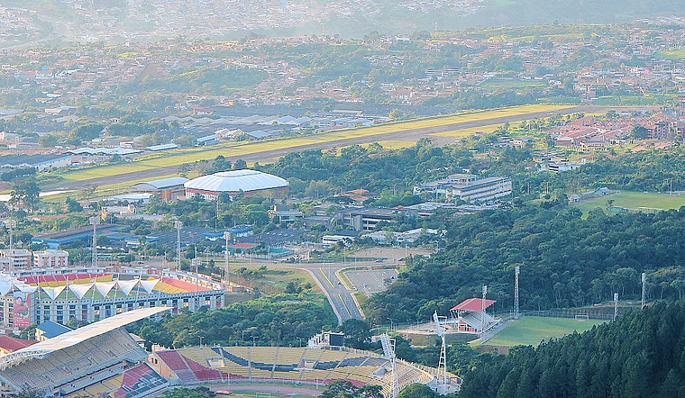
Photo: Unukalhai, CC BY-SA 3.0.
Paramillo Airport is an airport serving San Cristóbal, the capital of the Táchira state of Venezuela. The runway is in Paramillo, 4 kilometres north of San Cristóbal. The Paramillo non-directional beacon is located on the field. San Cristóbal Paramillo Airport is situated 4 km southwest of San Rafael.
Places in the Area
Nearby places include Táriba and Palmira.
Táriba
Town

Photo: Tariba1, CC BY-SA 3.0.
Táriba is a town in Táchira, Venezuela, and is the capital of the Cárdenas Municipality. It was founded in 1602. Táriba has a population of 128,590. It's located on the outsides of the city of San Cristóbal. Táriba is situated 4 km west of San Rafael.
Palmira
Town
Palmira is a town in Táchira, Venezuela. It is the capital of Guásimos Municipality. It was founded in 1627 by Fernando Saavedra and in 1642 by Captain Luis Sosa Lovera. In 2011, it had a population of 43.236. Palmira is situated 4½ km west of San Rafael.
San Cristóbal

Photo: Rufino, CC BY-SA 2.0.
San Cristobal is a leafy, prosperous city of west Venezuela. The city is in a mountainous valley in the temperate green hills of the Andes bordering Colombia.
San Rafael
- Type: Neighborhood
- Category: locality
- Location: Cárdenas Municipality, Táchira, Andes, Venezuela, South America
- View on OpenStreetMap
Latitude
7.83436° or 7° 50′ 4″ northLongitude
-72.18842° or 72° 11′ 18″ westElevation
1,241 metres (4,072 feet)Open location code
67V9RRM6+PJOpenStreetMap ID
way 246570956OpenStreetMap feature
place=neighbourhoodGeoNames ID
3759272
This page is based on OpenStreetMap, GeoNames, Wikidata, and Wikimedia Commons.
We’d love your help improving our open data sources. Thank you for contributing.
Satellite Map
Discover San Rafael from above in high-definition satellite imagery.
In Other Languages
“San Rafael” goes by many names.
- Spanish: “San Rafael”
Places with the Same Name
Discover other places named “San Rafael”.
Localities in the Area
Explore places such as El Junco and El Llanito.
Notable Places Nearby
Highlights include Plaza Andrés Bello and Medicatura Cordero.
Andes: Must-Visit Destinations
Delve into Mérida, Trujillo, San Cristóbal, and Santo Domingo.
Curious Places to Discover
Uncover intriguing places from every corner of the globe.
About Mapcarta. Data © OpenStreetMap contributors and available under the Open Database License". Text is available under the CC BY-SA 4.0 license, except for photos, directions, and the map. Photo: Wikimedia, CC0.