Openbare Basisschool Sprengenpark
Openbare Basisschool Sprengenpark is a school in Apeldoorn, Veluwe, Gelderland. Openbare Basisschool Sprengenpark is situated nearby to the village Ugchelen, as well as near Hoog Soeren.| Tap on a place to explore it |
- Email: sprengenpark@leerplein055.nl
- Type: School
- Also known as: “Openbare basisschool Sprengenpark”
Places of Interest Nearby
Highlights include CODA Apeldoorn and Apenheul Primate Park.
CODA Apeldoorn
Museum

Photo: Codawebmaster, CC BY-SA 4.0.
CODA Apeldoorn is a museum, which is situated 1 km northeast of Openbare Basisschool Sprengenpark.
Apenheul Primate Park
Zoo

Photo: Edoderoo, CC BY-SA 3.0.
Apenheul Primate Park is a zoo in Apeldoorn, Netherlands. It specializes in apes and monkeys. It opened in 1971 and was the first zoo in the world where monkeys could walk around freely in the forest and between the visitors. Apenheul Primate Park is situated 2 km west of Openbare Basisschool Sprengenpark.
Apeldoorn railway station
Railway station
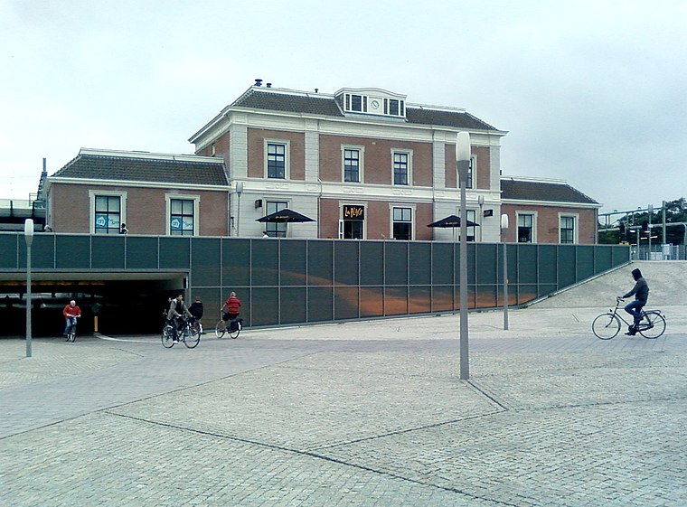 Apeldoorn railway station is a railway station in Apeldoorn, Netherlands. The station was opened on 15 May 1876, on the Amsterdam–Zutphen railway. It was opened when the Amersfoort to Zutphen section was completed. Apeldoorn railway station is situated 1½ km east of Openbare Basisschool Sprengenpark.
Places in the Area
Nearby places include Ugchelen and Hoog Soeren.
Ugchelen
Village
Ugchelen is part of the municipality of Apeldoorn in the Gelderland province of the Netherlands, and is today seen as a village. Ugchelen is located South West of Apeldoorn and has about 7000 inhabitants. Ugchelen is situated 3 km south of Openbare Basisschool Sprengenpark.
Hoog Soeren
Village

Photo: Apdency, Public domain.
Hoog Soeren is a village in the municipality of Apeldoorn, in the province of Gelderland in the Netherlands. Since 1863, it is a crown land. Hoog Soeren is situated 5 km west of Openbare Basisschool Sprengenpark.
Wenum
Village
Wenum-Wiesel is a twin village in the municipality of Apeldoorn, in the province of Gelderland in the Netherlands. In 1978, the hamlets of Wenum and Wiesel merged into a village. Wenum is situated 5 km north of Openbare Basisschool Sprengenpark.
Openbare Basisschool Sprengenpark
- Category: education
- Location: Apeldoorn, Veluwe, Gelderland, Eastern Netherlands, Netherlands, Benelux, Europe
- View on OpenStreetMap
Latitude
52.21098° or 52° 12′ 40″ northLongitude
5.94355° or 5° 56′ 37″ eastElevation
26 metres (85 feet)Open location code
9F476W6V+9COpenStreetMap ID
way 693943187OpenStreetMap feature
amenity=schoolGeoNames ID
6955583
This page is based on OpenStreetMap, GeoNames, Wikidata, and Wikimedia Commons.
We’d love your help improving our open data sources. Thank you for contributing.
Satellite Map
Discover Openbare Basisschool Sprengenpark from above in high-definition satellite imagery.
Localities in the Area
Explore places such as Driehuizen and West.
Nearby Places
Explore places such as Aesthetic Company and Veluwe Tandartsen.
Veluwe: Must-Visit Destinations
Delve into Ede, Wageningen, Harderwijk, and Elburg.
Curious Schools to Discover
Uncover intriguing schools from every corner of the globe.
About Mapcarta. Data © OpenStreetMap contributors and available under the Open Database License". Text is available under the CC BY-SA 4.0 license, except for photos, directions, and the map. Photo: Kleinleugenmors, CC BY-SA 3.0.