Fazenda São José
Fazenda São José is a farm in Jumirim, São Paulo. Fazenda São José is situated nearby to the locality Jequitaia, as well as near the village Jumirim.| Tap on a place to explore it |
Places in the Area
Nearby places include Jequitaia and Jumirim.

Jumirim
Village
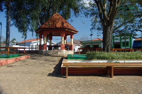
Photo: Reynaldo, CC BY-SA 3.0.
Jumirim is a municipality in the state of São Paulo in Brazil. It is part of the Metropolitan Region of Sorocaba. The population is 3,418 in an area of 56.69 km2. The elevation is 561 m.
Pedro Zanella
Suburb

Photo: IgorEliezer, CC BY-SA 4.0.
Pedro Zanella is a suburb, which is situated 4½ km northwest of Fazenda São José.
Fazenda São José
- Type: Farm
- Also known as: “Fazenda Sao Jose”
- Category: agriculture
- Location: Jumirim, São Paulo, Southeast, Brazil, South America
- View on OpenStreetMap
Latitude
-23.0996° or 23° 5′ 59″ southLongitude
-47.8038° or 47° 48′ 14″ westElevation
490 metres (1,608 feet)Open location code
588JW52W+5FGeoNames ID
7588688
This page is based on GeoNames, Wikidata, and Wikimedia Commons.
We’d love your help improving our open data sources. Thank you for contributing.
Satellite Map
Discover Fazenda São José from above in high-definition satellite imagery.
In Other Languages
“Fazenda São José” goes by many names.
- Portuguese: “Fazenda São José”
Places with the Same Name
Discover other places named “Fazenda São José”.
Localities in the Area
Explore places such as Dona Luísa and Sítio Jumirim.
Notable Places Nearby
Highlights include Cachoeira Jequitaia and Morro do Janjão.
São Paulo: Must-Visit Destinations
Delve into São Paulo, Osasco, Santos, and Campinas.
Curious Farms to Discover
Uncover intriguing farms from every corner of the globe.
About Mapcarta. Text is available under the CC BY-SA 4.0 license, except for photos, directions, and the map. Photo: Wikimedia, CC BY-SA 3.0.