Çaldere
Çaldere is a village in Akkuş, Ordu and has about 173 residents and an elevation of 1,101 metres. Çaldere is situated nearby to the neighborhood Cüceyüzü, as well as near the suburb Yazlıkbelen.| Tap on a place to explore it |
- Type: Village with 173 residents
- Description: mahalle (adminstrative quarter) in Akkuş, Ordu, northern Turkey
- Also known as: “Caldere”
Places in the Area
Nearby places include Akkuş and Yukarıdüğencili.
Akkuş
Town

Photo: Bysk86, CC BY-SA 3.0.
Akkuş is a municipality and district of Ordu Province, Turkey. Its area is 697 km2, and its population is 21,258. The town lies at an elevation of 1,313 m.
Yukarıdüğencili
Village
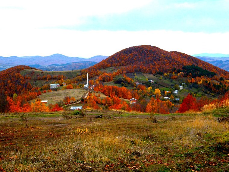
Photo: Bysk86, CC BY-SA 3.0.
Yukarıdüğencili is a village, which is situated 6 km south of Çaldere.
Çaldere
- Categories: mahalle and locality
- Location: Akkuş, Ordu, Turkey, Middle East, Asia
- View on OpenStreetMap
Latitude
40.80014° or 40° 48′ 1″ northLongitude
37.00635° or 37° 0′ 23″ eastPopulation
173Elevation
1,101 metres (3,612 feet)Open location code
8GGVR224+3GOpenStreetMap ID
node 2390586095OpenStreetMap feature
place=villageGeoNames ID
7602880Wikidata ID
Q109392250
This page is based on OpenStreetMap, GeoNames, Wikidata, and Wikimedia Commons.
We’d love your help improving our open data sources. Thank you for contributing.
Satellite Map
Discover Çaldere from above in high-definition satellite imagery.
In Other Languages
From Chechen to Vietnamese—“Çaldere” goes by many names.
- Chechen: “Чалдере”
- Tatar: “Чалдере”
- Turkish: “Çaldere, Akkuş”
- Turkish: “Çaldere”
- Vietnamese: “Çaldere”
- “Çaldere”
Places with the Same Name
Discover other places named “Çaldere”.
Localities in the Area
Explore places such as Cüceyüzü and Yazlıkbelen.
Notable Places Nearby
Highlights include Mezarlık and Kapalı Spor Salonu.
Turkey: Must-Visit Destinations
Delve into Istanbul, Edirne, Ankara, and Izmir.
Curious Places to Discover
Uncover intriguing places from every corner of the globe.
About Mapcarta. Data © OpenStreetMap contributors and available under the Open Database License". Text is available under the CC BY-SA 4.0 license, except for photos, directions, and the map. Photo: Moonik, CC BY-SA 3.0.