Rue de l’Hôtel de Ville
Rue de l’Hôtel de Ville is a street in Paris, Île-de-France. Rue de l’Hôtel de Ville is situated nearby to the metro station Pont Marie station, as well as near the islet Île Saint-Louis.| Tap on a place to explore it |
Places of Interest Nearby
Highlights include Notre Dame de Paris and Île Saint-Louis.
Notre Dame de Paris
Church
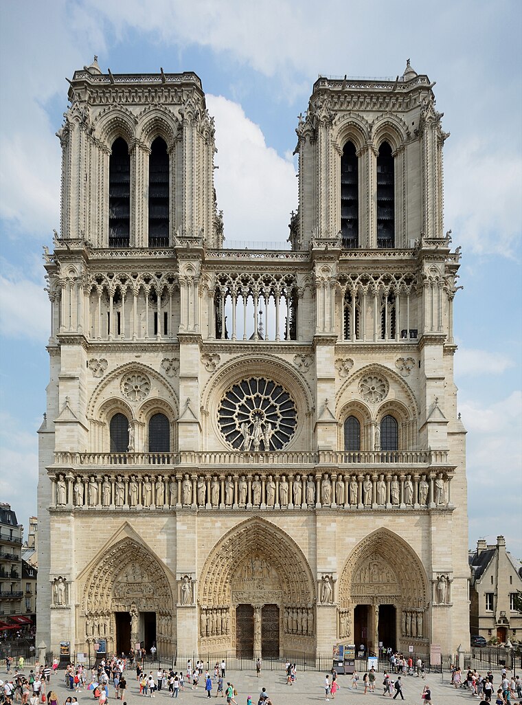
Photo: P e z i, CC BY-SA 3.0.
Notre-Dame de Paris, often referred to simply as Notre-Dame, is a medieval Catholic cathedral on the Île de la Cité, in the 4th arrondissement of Paris, France. Notre Dame de Paris is situated 510 metres west of Rue de l’Hôtel de Ville.
Île Saint-Louis
Islet

Photo: Moonik, CC BY-SA 3.0.
Île Saint-Louis, eleven hectares in size, is one of two natural islands in the Seine river, in Paris, France. Île Saint-Louis is connected to the rest of Paris by four bridges to both banks of the river and to the Île de la Cité by the Pont Saint-Louis.
Pont Marie station
Metro station

Photo: Chabe01, CC BY-SA 4.0.
Pont Marie is a station of the Paris Métro opened in 1926 with the extension of Line 7 from Palais Royal–Musée du Louvre. It is named after the nearby bridge over the Seine, the Pont Marie, which connects to Île Saint-Louis.
Places in the Area
Nearby places include 4th arrondissement and Marais.
4th arrondissement

Photo: Björn Söderqvist, CC BY-SA 2.0.
The 4th is a good chunk of what used to be medieval Paris, and you'll find a lot left from that time on both islands and in the narrow streets of the lower Marais.
Marais
Suburb

Photo: Luctor IV, Public domain.
The Marais is a historic district in Paris, France. It spreads across parts of the 3rd and 4th arrondissements on the Rive Droite, or Right Bank, of the Seine.
3rd arrondissement

Photo: Pol, Public domain.
A quieter part of the ancient Marais neighbourhood which is centred in the 4th, the 3rd is possibly one of the best places to live in Paris. There are several good open air markets and lots of great local designer clothing stores.
Rue de l’Hôtel de Ville
- Type: Street
- Also known as: “Rue de l’Hotel de Ville”
- Category: transportation
- Location: Paris, Île-de-France, France, Europe
- View on OpenStreetMap
Latitude
48.85403° or 48° 51′ 15″ northLongitude
2.35667° or 2° 21′ 24″ eastElevation
35 metres (115 feet)Open location code
8FW4V934+JMGeoNames ID
12494919
This page is based on GeoNames, Wikidata, and Wikimedia Commons.
We’d love your help improving our open data sources. Thank you for contributing.
Satellite Map
Discover Rue de l’Hôtel de Ville from above in high-definition satellite imagery.
In Other Languages
“Rue de l’Hôtel de Ville” goes by many names.
- French: “Rue de la Mortellerie” (historical)
Places with the Same Name
Discover other places named “Rue de l’Hôtel de Ville”.
Localities in the Area
Explore places such as Quartier Saint-Merri and Quartier Saint-Victor.
Nearby Places
Explore places such as Ancien quai des Ormes and Quai de l’Hôtel de Ville.
Paris: Must-Visit Destinations
Delve into La Défense, 1st arrondissement, 7th arrondissement, and 8th arrondissement.
Curious Places to Discover
Uncover intriguing places from every corner of the globe.
About Mapcarta. Text is available under the CC BY-SA 4.0 license, except for photos, directions, and the map. Photo: Benh, CC BY-SA 4.0.