Ancienne rue des Arcis
Ancienne rue des Arcis is an ancient road in Paris, Île-de-France. Ancienne rue des Arcis is situated nearby to Saint-Jacques Tower, as well as near the arts center Centre Georges Pompidou.| Tap on a place to explore it |
Places of Interest Nearby
Highlights include Centre Georges Pompidou and Saint-Jacques Tower.
Centre Georges Pompidou
Arts center

Photo: Zairon, CC BY-SA 4.0.
The Centre Pompidou, more fully the Centre national d'art et de culture Georges-Pompidou, also known as the Pompidou Centre in English and colloquially as Beaubourg, is a building complex in Paris, France. Centre Georges Pompidou is situated 270 metres northeast of Ancienne rue des Arcis.
Saint-Jacques Tower

Photo: Mbzt, CC BY-SA 3.0.
Tour Saint-Jacques is a monument located in the 4th arrondissement of Paris, France, on the Rive Droite. This 52-metre Flamboyant Gothic tower at the intersection of the Rue de Rivoli with Rue Nicolas-Flamel is all that remains of the former medieval Church… Saint-Jacques Tower is situated 110 metres southwest of Ancienne rue des Arcis.
Notre Dame de Paris
Church
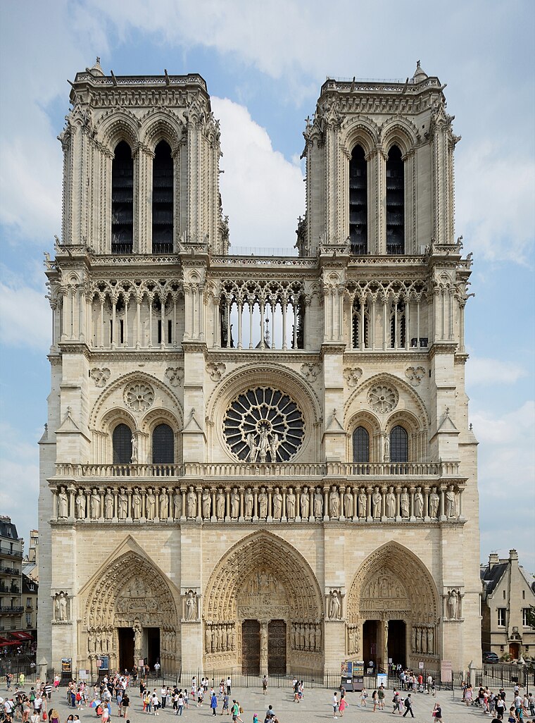
Photo: P e z i, CC BY-SA 3.0.
Notre-Dame de Paris, often referred to simply as Notre-Dame, is a medieval Catholic cathedral on the Île de la Cité, in the 4th arrondissement of Paris, France. Notre Dame de Paris is situated 640 metres south of Ancienne rue des Arcis.
Places in the Area
Nearby places include 4th arrondissement and Quartier des Halles.
4th arrondissement

Photo: Björn Söderqvist, CC BY-SA 2.0.
The 4th is a good chunk of what used to be medieval Paris, and you'll find a lot left from that time on both islands and in the narrow streets of the lower Marais.
Quartier des Halles
Suburb

Photo: Mbzt, CC BY-SA 3.0.
Les Halles was Paris's central fresh food market. It last operated on 12 January 1973 and was replaced by an underground shopping centre and a park. The unpopular modernist development was demolished yet again in 2010, and replaced by the Westfield Forum des Halles, a modern shopping mall built largely underground and topped by an undulating 2.5 hectare canopy.
Marais
Suburb

Photo: Luctor IV, Public domain.
The Marais is a historic district in Paris, France. It spreads across parts of the 3rd and 4th arrondissements on the Rive Droite, or Right Bank, of the Seine.
Ancienne rue des Arcis
- Type: Ancient road
- Category: transportation
- Location: Paris, Île-de-France, France, Europe
- View on OpenStreetMap
Latitude
48.85872° or 48° 51′ 31″ northLongitude
2.34995° or 2° 20′ 60″ eastElevation
35 metres (115 feet)Open location code
8FW4V85X+FXGeoNames ID
12495355
This page is based on GeoNames, Wikidata, and Wikimedia Commons.
We’d love your help improving our open data sources. Thank you for contributing.
Satellite Map
Discover Ancienne rue des Arcis from above in high-definition satellite imagery.
Localities in the Area
Explore places such as Quartier Saint-Merri and Place de l’Hôtel-de-Ville – Esplanade de la Libération.
Nearby Places
Explore places such as Rue Saint-Bon and Rue du Cloître-Saint-Merri.
Paris: Must-Visit Destinations
Delve into La Défense, 1st arrondissement, 7th arrondissement, and 2nd arrondissement.
Curious Places to Discover
Uncover intriguing places from every corner of the globe.
About Mapcarta. Text is available under the CC BY-SA 4.0 license, except for photos, directions, and the map. Photo: Benh, CC BY-SA 4.0.