Kaiser
Kaiser is a farm in Helmstorf, Plön, Schleswig-Holstein. Kaiser is situated nearby to the village Kühren, as well as near Högsdorf.| Tap on a place to explore it |
Places of Interest
Highlights include St. Michaeliskirche (Lütjenburg) and Bismarckturm (Lütjenburg).
St. Michaeliskirche (Lütjenburg)
Church

Photo: Trinsath, Public domain.
St. Michaeliskirche (Lütjenburg) is a church, which is situated 3 km north of Kaiser.
Bismarckturm (Lütjenburg)

Photo: Holger.Ellgaard, CC BY-SA 4.0.
Bismarckturm (Lütjenburg) is situated 3½ km north of Kaiser.
Großsteingräber bei Futterkamp
Archaeological site

Photo: Genet, CC BY-SA 3.0.
Großsteingräber bei Futterkamp is an archaeological site, which is situated 4 km northeast of Kaiser.
Places in the Area
Nearby places include Högsdorf and Kletkamp.
Högsdorf
Village
Högsdorf is a municipality in the district of Plön, in Schleswig-Holstein, Germany.
Kletkamp
Village
Kletkamp is a municipality in the district of Plön, in Schleswig-Holstein, Germany. Kletkamp is situated 3 km southeast of Kaiser.
Lütjenburg
Town
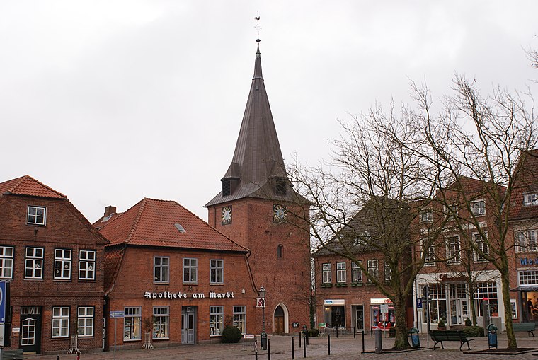
Photo: PodracerHH, CC BY-SA 3.0.
Lütjenburg is a town of the district of Plön, Schleswig-Holstein, Germany. It is located approximately 18 km northeast of Plön, and 30 km east of Kiel. Lütjenburg is situated 3 km north of Kaiser.
Kaiser
- Type: Farm
- Category: agriculture
- Location: Helmstorf, Plön, Schleswig-Holstein, Germany, Central Europe, Europe
- View on OpenStreetMap
Latitude
54.2656° or 54° 15′ 56″ northLongitude
10.60248° or 10° 36′ 9″ eastElevation
45 metres (148 feet)Open location code
9F6G7J82+6XGeoNames ID
13289025
This page is based on GeoNames, Wikidata, and Wikimedia Commons.
We’d love your help improving our open data sources. Thank you for contributing.
Satellite Map
Discover Kaiser from above in high-definition satellite imagery.
In Other Languages
“Kaiser” goes by many names.
- German: “Kaiser”
Places with the Same Name
Discover other places named “Kaiser”.
Localities in the Area
Explore places such as Kühren and Helmstorf.
Notable Places Nearby
Highlights include Kührener missen and Voßberg.
Schleswig-Holstein: Must-Visit Destinations
Delve into Kiel, Lübeck, Flensburg, and Heligoland.
Curious Places to Discover
Uncover intriguing places from every corner of the globe.
About Mapcarta. Text is available under the CC BY-SA 4.0 license, except for photos, directions, and the map. Photo: Ypsilon from Finland, CC0.