Voßberg
Voßberg is a farm in Grömitz, Ostholstein, Schleswig-Holstein. Voßberg is situated nearby to the hamlet Stadtfurth, as well as near Ziegelhof.| Tap on a place to explore it |
Places of Interest
Highlights include Haus der Natur Cismar and Cismar Abbey.

Cismar Abbey
Church
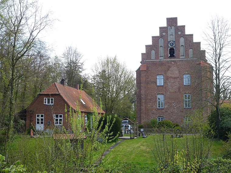
Photo: Rosa-Maria Rinkl, CC BY-SA 4.0.
Cismar Abbey was a Benedictine monastery located at Cismar near Grömitz, Schleswig-Holstein, in Germany.
Zoo Arche Noah
Zoo

Photo: Veliensis, CC BY-SA 4.0.
Zoo Arche Noah is situated 3 km south of Voßberg.
Places in the Area
Nearby places include Cismar and Manhagen.

Manhagen
Village
Manhagen is a municipality in the district of Ostholstein, in Schleswig-Holstein, Germany. Manhagen is situated 3½ km northwest of Voßberg.
Kabelhorst
Village
Kabelhorst is a municipality in the district of Ostholstein, in Schleswig-Holstein, Germany. Kabelhorst is situated 5 km northwest of Voßberg.
Voßberg
- Type: Farm
- Also known as: “Vossberg”
- Category: agriculture
- Location: Grömitz, Ostholstein, East Holstein, Schleswig-Holstein, Germany, Central Europe, Europe
- View on OpenStreetMap
Latitude
54.17994° or 54° 10′ 48″ northLongitude
10.96228° or 10° 57′ 44″ eastElevation
10 metres (33 feet)Open location code
9F6G5XH6+XWGeoNames ID
13349097
This page is based on GeoNames, Wikidata, and Wikimedia Commons.
We’d love your help improving our open data sources. Thank you for contributing.
Satellite Map
Discover Voßberg from above in high-definition satellite imagery.
In Other Languages
“Voßberg” goes by many names.
- German: “Voßberg”
Places with the Same Name
Discover other places named “Voßberg”.
Localities in the Area
Explore places such as Stadtfurth and Ziegelhof.
Notable Places Nearby
Highlights include Schmiedeholz and Bornholz.
East Holstein: Must-Visit Destinations
Delve into Lübeck, Fehmarn, Ratzeburg, and Timmendorfer Strand.
Curious Places to Discover
Uncover intriguing places from every corner of the globe.
About Mapcarta. Text is available under the CC BY-SA 4.0 license, except for photos, directions, and the map. Photo: Andreas Geick, CC BY-SA 3.0.