Lübscherkamper Wettern
Lübscherkamper Wettern is a ditch in Itzehoe, Steinburg, Schleswig-Holstein. Lübscherkamper Wettern is situated nearby to the suburb Wellenkamp, as well as near the village Heiligenstedtenerkamp.| Tap on a place to explore it |
Places of Interest
Highlights include Wenzel-Hablik-Museum and Itzehoe station.
Wenzel-Hablik-Museum
Museum

Photo: Wikimedia, CC BY-SA 3.0.
Wenzel-Hablik-Museum is situated 2½ km east of Lübscherkamper Wettern.
Itzehoe station
Railway station
 Itzehoe station is a railway station in the town of Itzehoe in the German state of Schleswig-Holstein. It is located on the Marsh Railway, which is electrified from Elmshorn up to this point. It is classified by Deutsche Bahn as a category 3 station.
Prinzesshof
Museum
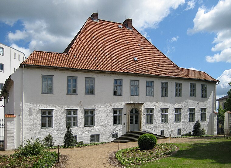
Photo: Nightflyer, CC BY 3.0.
Prinzesshof is a museum, which is situated 2½ km northeast of Lübscherkamper Wettern.
Places in the Area
Nearby places include Münsterdorf and Wilster.
Münsterdorf
Village
 Münsterdorf is a municipality in the district of Steinburg, in Schleswig-Holstein, Germany. Münsterdorf is situated 4 km east of Lübscherkamper Wettern.
Wilster
Town

Photo: TheBo, CC BY-SA 3.0.
Wilster is a town in Steinburg district in Schleswig-Holstein, Germany. Wilster is situated 7 km west of Lübscherkamper Wettern.
Lägerdorf
Village
 Lägerdorf is a municipality in the district of Steinburg, in Schleswig-Holstein, Germany. Lägerdorf is situated 7 km southeast of Lübscherkamper Wettern.
Lübscherkamper Wettern
- Type: Ditch
- Also known as: “Lubscherkamper Wettern”
- Category: body of water
- Location: Itzehoe, Steinburg, South Holstein, Schleswig-Holstein, Germany, Central Europe, Europe
- View on OpenStreetMap
Latitude
53.91321° or 53° 54′ 48″ northLongitude
9.478° or 9° 28′ 41″ eastElevation
5 metres (16 feet)Open location code
9F5FWF7H+76GeoNames ID
13399342
This page is based on GeoNames, Wikidata, and Wikimedia Commons.
We’d love your help improving our open data sources. Thank you for contributing.
Satellite Map
Discover Lübscherkamper Wettern from above in high-definition satellite imagery.
In Other Languages
“Lübscherkamper Wettern” goes by many names.
- German: “Lübscherkamper Wettern”
Localities in the Area
Explore places such as Wellenkamp and Lübscher Kamp.
Notable Places Nearby
Highlights include Schloss Heiligenstedten and Bekau.
South Holstein: Must-Visit Destinations
Delve into Neumünster, Wedel, Glückstadt, and Bad Segeberg.
Curious Ditches to Discover
Uncover intriguing ditches from every corner of the globe.
About Mapcarta. Text is available under the CC BY-SA 4.0 license, except for photos, directions, and the map. Photo: C.Löser, CC BY 3.0 de.