Oldham Council - Metropolitan Place
Oldham Council - Metropolitan Place is a government office in Oldham, England which is located on Hobson Street. Oldham Council - Metropolitan Place is situated nearby to the government office Department for Work and Pensions, as well as near HM Revenue & Customs.| Tap on a place to explore it |
Places of Interest Nearby
Highlights include Gallery Oldham and Oldham Parish Church.
Gallery Oldham
Art gallery

Photo: SMJ, CC BY-SA 2.0.
Gallery Oldham is a free-to-view public museum and art gallery in the Cultural Quarter of central Oldham, in Greater Manchester, England. Gallery Oldham is situated 870 feet east of Oldham Council - Metropolitan Place.
Oldham Parish Church
Church

Photo: Rept0n1x, CC BY-SA 3.0.
The Church of St Mary with St Peter, commonly known as Oldham Parish Church, is the Church of England parish church of Oldham in Greater Manchester, England. Oldham Parish Church is situated 1,200 feet north of Oldham Council - Metropolitan Place.
Our Lady of Mount Carmel and St Patrick Church
Church
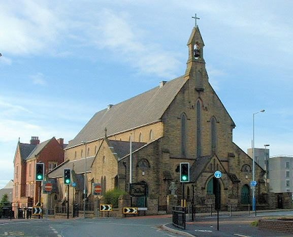
Photo: Wikimedia, CC BY-SA 2.0 uk.
Our Lady of Mount Carmel and St Patrick Church or St Patrick's Church is a Roman Catholic Parish church in Oldham, Greater Manchester, England. It was founded in 1858 and was built in 1870. Our Lady of Mount Carmel and St Patrick Church is situated 1,300 feet west of Oldham Council - Metropolitan Place.
Places in the Area
Nearby places include Oldham and Coppice.
Oldham

Photo: Parrot of Doom, CC BY-SA 3.0.
Oldham is a former textile town in Greater Manchester, 7 miles northeast of city centre in the foothills of the Pennines. The main reason to visit is to explore the villages and valleys leading into the Pennines. In 2011 the population was over 96,000.
Coppice
Suburb
Coppice is a locality and urban/suburban area the town of Oldham, in Greater Manchester, England. It is located to the south of Oldham town centre and is contiguous with other areas of Oldham including Hathershaw, Werneth, Hollins, Copster Hill and Primrose Bank.
Coldhurst
Suburb
Coldhurst is an area of Oldham and an electoral ward of the wider Metropolitan Borough of Oldham in Greater Manchester, England. At the time of the United Kingdom Census 2001, it had a population of 11,935, increasing to 13,201 at the 2011 Census.
Oldham Council - Metropolitan Place
- Type: Government office
- Address: Hobson Street, Oldham, OL1 1TT
- Categories: office and government building
- Location: Oldham, England, United Kingdom, Britain and Ireland, Europe
- View on OpenStreetMap
Latitude
53.53938° or 53° 32′ 22″ northLongitude
-2.11297° or 2° 6′ 47″ westOpen location code
9C5VGVQP+QROpenStreetMap ID
node 10014288266OpenStreetMap feature
office=government
This page is based on OpenStreetMap, Wikidata, and Wikimedia Commons.
We’d love your help improving our open data sources. Thank you for contributing.
Satellite Map
Discover Oldham Council - Metropolitan Place from above in high-definition satellite imagery.
Notable Places Nearby
Highlights include Department for Work and Pensions and HM Revenue & Customs.
Nearby Places
Explore places such as New Bridge Group and The Springboard Project.
England: Must-Visit Destinations
Delve into London, Manchester, Sheffield, and Leeds.
Curious Government Offices to Discover
Uncover intriguing government offices from every corner of the globe.
About Mapcarta. Data © OpenStreetMap contributors and available under the Open Database License". Text is available under the CC BY-SA 4.0 license, except for photos, directions, and the map. Photo: sidibousaid, CC BY 2.0.