Newborough Ave
Newborough Ave is a bus stop in Llanishen, Cardiff, Wales. Newborough Ave is situated nearby to the recreation area Glider Field, as well as near the pitch Llanishen Skate Park.| Tap on a place to explore it |
Places of Interest Nearby
Highlights include St Isan’s Church and Ty Glas railway station.
St Isan’s Church
Church
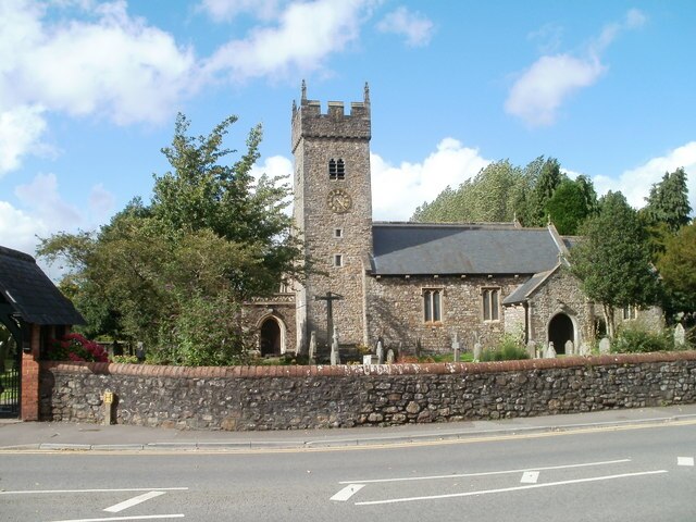
Photo: Wikimedia, CC BY-SA 2.0.
St Isan's Church is a listed Anglican church in the suburb of Llanishen, Cardiff. The church's origins are medieval, though the present building was extensively remodeled during the Victorian and Edwardian years. St Isan’s Church is situated 1,300 feet east of Newborough Ave.
Ty Glas railway station
Railway station
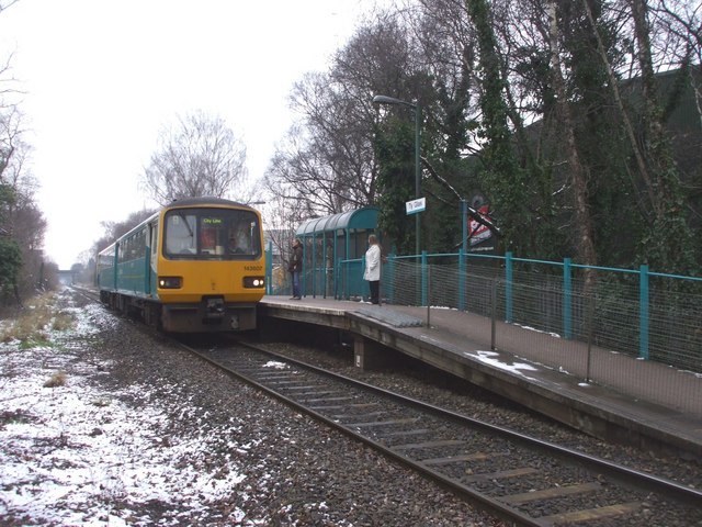
Photo: John Lord, CC BY-SA 2.0.
Ty Glas railway station is a railway station serving business and industrial sites in Llanishen and Heath, Cardiff, Wales. It is located on the Coryton Line 3.7 miles north of Cardiff Central. Ty Glas railway station is situated 2,500 feet south of Newborough Ave.
Birchgrove railway station
Railway station

Photo: Steve Chapple, CC BY-SA 2.0.
Birchgrove railway station is a railway station serving Birchgrove, Cardiff, Wales. It is located on the Coryton Line 3.75 miles north of Cardiff Central, with the station situated beneath the A469. Birchgrove railway station is situated 3,100 feet southwest of Newborough Ave.
Places in the Area
Nearby places include Birchgrove and Whitchurch.
Birchgrove
Suburb
Birchgrove is a district of the city of Cardiff stretching between Llanishen and the Gabalfa interchange, along the A469 Caerphilly road. It centres on a crossroads dominated by the Birchgrove pub which also lies between Heath and Whitchurch.
Whitchurch
Suburb

Photo: Welshleprechaun, Public domain.
Whitchurch is a suburb and community in the north of Cardiff, capital of Wales. It is approximately 3 miles north of the centre of the city on the A470 road and A4054 road. Whitchurch is situated 1½ miles southwest of Newborough Ave.
Coryton
Suburb
Coryton is a district of Cardiff, the capital city of Wales, lying immediately to the north of Whitchurch next to junction 32 of the M4 motorway. It is within the Whitchurch & Tongwynlais electoral ward. Coryton is situated 2 miles west of Newborough Ave.
Newborough Ave
- Type: Bus stop
- Category: transportation
- Location: Llanishen, Cardiff, Wales, United Kingdom, Britain and Ireland, Europe
- View on OpenStreetMap
Latitude
51.52836° or 51° 31′ 42″ northLongitude
-3.19422° or 3° 11′ 39″ westOpen location code
9C3RGRH4+88OpenStreetMap ID
node 10023144004OpenStreetMap feature
highway=bus_stopOpenStreetMap feature
public_transport=platform
This page is based on OpenStreetMap, Wikidata, and Wikimedia Commons.
We’d love your help improving our open data sources. Thank you for contributing.
Satellite Map
Discover Newborough Ave from above in high-definition satellite imagery.
Notable Places Nearby
Highlights include Glider Field and Llanishen Skate Park.
Nearby Places
Explore places such as Newborough Ave and Llanishen Park Changing Rooms.
Wales: Must-Visit Destinations
Delve into Swansea, Newport, Llanfairpwllgwyngyll, and Bangor.
Curious Bus Stops to Discover
Uncover intriguing bus stops from every corner of the globe.
About Mapcarta. Data © OpenStreetMap contributors and available under the Open Database License". Text is available under the CC BY-SA 4.0 license, except for photos, directions, and the map. Photo: Gordon Plant, CC BY 2.0.