Rowntree Park Gates
Rowntree Park Gates is in York, England. Rowntree Park Gates is situated nearby to Rowntree Park Tennis Club Pavilion, as well as near the historic building Pikeing Well.| Tap on a place to explore it |
Places of Interest Nearby
Highlights include Rowntree Park and Pikeing Well.
Rowntree Park
Park

Photo: Dashwortley, CC BY-SA 3.0.
Rowntree Park is a 20-acre park in York, England, open to the public, opened on 16 July 1921.
Pikeing Well
Historic building

Photo: Gordon Hatton, CC BY-SA 2.0.
The Pikeing Well, occasionally known as Lady Well, is a well in the city of York, in England. The well lies on New Walk, which runs along the east bank of the River Ouse, Yorkshire, running south from the city centre. Pikeing Well is situated 370 feet east of Rowntree Park Gates.
York Minster
Church
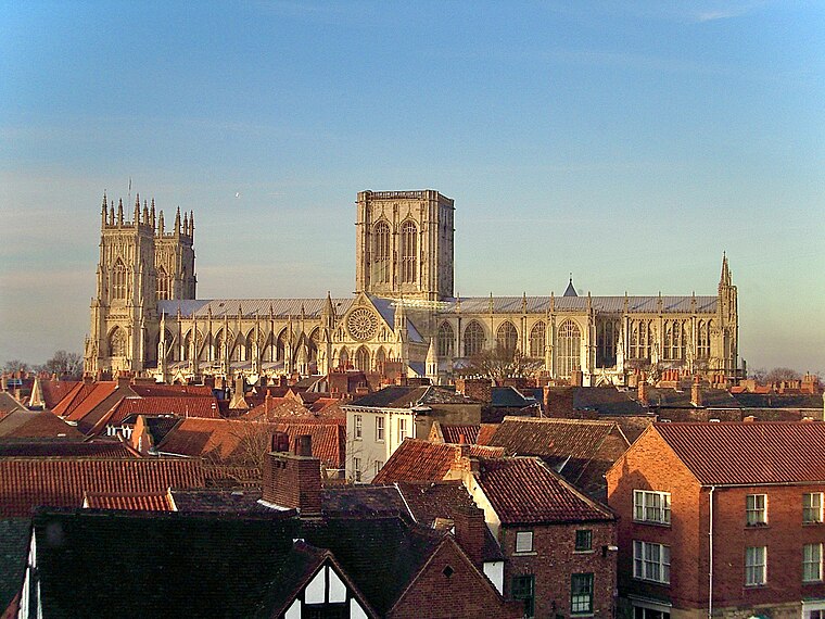
Photo: MatzeTrier, CC BY-SA 3.0.
York Minster, formally the Cathedral and Metropolitical Church of Saint Peter in York, is an Anglican cathedral in the city of York, North Yorkshire, England. York Minster is situated 1 mile north of Rowntree Park Gates.
Places in the Area
Nearby places include Fishergate and South Bank.
South Bank
Suburb
South Bank is an area of York in the county of North Yorkshire, England. It is to the south of the River Ouse. It was home to the now-closed Terry's Chocolate Works.
Bishophill
Suburb
Bishophill is an area of central York, in England. It lies within the city walls and has been occupied since at least the Roman period.
Rowntree Park Gates
- Type: Sign
- Categories: information and tourism
- Location: York, England, United Kingdom, Britain and Ireland, Europe
- View on OpenStreetMap
Latitude
53.94815° or 53° 56′ 53″ northLongitude
-1.08006° or 1° 4′ 48″ westOpen location code
9C5WWWX9+7XOpenStreetMap ID
node 10080334327OpenStreetMap feature
tourism=information
This page is based on OpenStreetMap, Wikidata, and Wikimedia Commons.
We’d love your help improving our open data sources. Thank you for contributing.
Satellite Map
Discover Rowntree Park Gates from above in high-definition satellite imagery.
Notable Places Nearby
Highlights include Rowntree Park Tennis Club Pavilion and Rowntree Park reading cafe Library.
Nearby Places
Explore places such as York Millennium Riverwalks and Pikeing Well.
England: Must-Visit Destinations
Delve into London, Manchester, Sheffield, and Leeds.
Curious Places to Discover
Uncover intriguing places from every corner of the globe.
About Mapcarta. Data © OpenStreetMap contributors and available under the Open Database License". Text is available under the CC BY-SA 4.0 license, except for photos, directions, and the map. Photo: sidibousaid, CC BY 2.0.