McDonald’s Playplace
McDonald’s Playplace is a recreation area in Contra Costa, California. McDonald’s Playplace is situated nearby to Karate, as well as near the health club AchieveFit Boot Camp.| Tap on a place to explore it |
Places of Interest Nearby
Highlights include Old St. Raymond’s Church and Dublin High School.
Old St. Raymond’s Church
Church
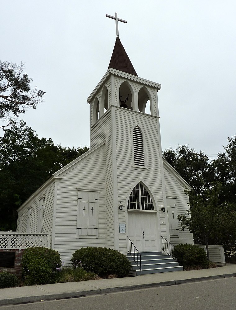 Old St. Raymond Church is a historic church in Dublin, California. The building was placed on the National Register of Historic Places on April 12, 2006. Old St. Raymond’s Church is situated 1½ miles south of McDonald’s Playplace.
Dublin High School
School

Photo: DublinRanch, CC BY-SA 3.0.
Dublin High School is a four-year high school located in the East San Francisco Bay Area. It is one of the two high schools in Dublin, California, along with Emerald High School and serves about 3,200 students. Dublin High School is situated 1 mile east of McDonald’s Playplace.
Stoneridge Shopping Center
Shopping center
Stoneridge Shopping Center is an upscale major shopping mall in Pleasanton, California. The mall is managed and co-owned by Simon Property Group, and is adjacent to Interstate 680. The mall features JCPenney and Macy's and Macy's Women's Store. Stoneridge Shopping Center is situated 2 miles south of McDonald’s Playplace.
Places in the Area
Nearby places include Dublin and Tri-Valley.
Dublin

Photo: Fastily, CC BY-SA 4.0.
Dublin is a city of 65,000 people on the northern side of Alameda County, in California's East Bay region. It's an expanding city, constantly making its way into the golden-colored foothills of the Diablo Range on its eastern and western sides.
Tri-Valley

Photo: Firstcultural, CC0.
The Tri-Valley area is grouping of three valleys in the East Bay region of California's Bay Area. The three valleys are Amador Valley, Livermore Valley, and San Ramon Valley.
Dougherty
Hamlet
Dougherty was an unincorporated community in Alameda County, California. It was associated with two separate areas near Dublin, the first at an elevation of 348 feet. Dougherty is situated 2 miles southeast of McDonald’s Playplace.
McDonald’s Playplace
- Type: Recreation area
- Categories: tourist attraction and tourism
- Location: Contra Costa, California, United States, North America
- View on OpenStreetMap
Latitude
37.72444° or 37° 43′ 28″ northLongitude
-121.94317° or 121° 56′ 35″ westOpen location code
849WP3F4+QPOpenStreetMap ID
node 10115193510OpenStreetMap feature
leisure=indoor_play
This page is based on OpenStreetMap, Wikidata, and Wikimedia Commons.
We’d love your help improving our open data sources. Thank you for contributing.
Satellite Map
Discover McDonald’s Playplace from above in high-definition satellite imagery.
Places with the Same Name
Discover other places named “McDonald’s Playplace”.
Notable Places Nearby
Highlights include Karate and AchieveFit Boot Camp.
Nearby Places
Explore places such as McDonald’s and Dairy Queen.
California: Must-Visit Destinations
Delve into San Francisco, Los Angeles, San Diego, and Sacramento.
Curious Recreation Areas to Discover
Uncover intriguing recreation areas from every corner of the globe.
About Mapcarta. Data © OpenStreetMap contributors and available under the Open Database License". Text is available under the CC BY-SA 4.0 license, except for photos, directions, and the map. Photo: Wikimedia, CC0.