Oldham Star
Oldham Star is a fast food restaurant in Oldham, England which is located on Manchester Street. Oldham Star is situated nearby to the sports venue swim! Oldham, as well as near the school Darul Hadis Latifiah Northwest.| Tap on a place to explore it |
- Type: Fast food restaurant
- Cuisine: kebab and pizza
- Address: 288 Manchester Street, Oldham, OL9 6HB
Places of Interest Nearby
Highlights include Darul Hadis Latifiah Northwest and Our Lady of Mount Carmel and St Patrick Church.
Darul Hadis Latifiah Northwest
School
Darul Hadis Latifiah Northwest is an Islamic private school for 11 to 16-year-old boys in Oldham, Greater Manchester, England. It was established in 2012 by parents and community leaders. Darul Hadis Latifiah Northwest is situated 370 feet south of Oldham Star.
Our Lady of Mount Carmel and St Patrick Church
Church
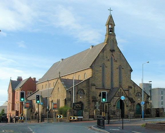
Photo: Wikimedia, CC BY-SA 2.0 uk.
Our Lady of Mount Carmel and St Patrick Church or St Patrick's Church is a Roman Catholic Parish church in Oldham, Greater Manchester, England. It was founded in 1858 and was built in 1870. Our Lady of Mount Carmel and St Patrick Church is situated 2,000 feet east of Oldham Star.
Boundary Park
Stadium

Photo: Narniauk, Public domain.
Boundary Park is a football stadium in Oldham, Greater Manchester, England. Its name originates from the fact that it lies at the northwestern extremity of Oldham, with Royton and Chadderton lying immediately north and west respectively. Boundary Park is situated 1¼ miles north of Oldham Star.
Places in the Area
Nearby places include Werneth and Coppice.
Werneth
Suburb

Photo: Alexander P Kapp, CC BY-SA 2.0.
Werneth is an area of Oldham, Greater Manchester, England. The population at the 2011 census was 12,348. It is 1 mile west-southwest of Oldham's commercial centre and one of its most ancient localities.
Coppice
Suburb
Coppice is a locality and urban/suburban area the town of Oldham, in Greater Manchester, England. It is located to the south of Oldham town centre and is contiguous with other areas of Oldham including Hathershaw, Werneth, Hollins, Copster Hill and Primrose Bank.
Cowhill
Quarter

Photo: Rept0n1x, CC BY-SA 3.0.
Cowhill is a locality of Chadderton, in the Metropolitan Borough of Oldham, Greater Manchester, England. It is located 0.5 miles southeast of Chadderton town centre close to its eastern boundary with Oldham and is contiguous with the Block Lane, Stock Brook, Butler Green and Nimble Nook areas of the town and with Freehold and Westwood in Oldham.
Oldham Star
- Categories: food and restaurant
- Location: Oldham, England, United Kingdom, Britain and Ireland, Europe
- View on OpenStreetMap
Latitude
53.53758° or 53° 32′ 15″ northLongitude
-2.12756° or 2° 7′ 39″ westOpen location code
9C5VGVQC+2XOpenStreetMap ID
node 10144743951OpenStreetMap feature
amenity=fast_foodOpenStreetMap attribute
cuisine=kebabOpenStreetMap attribute
cuisine=pizza
This page is based on OpenStreetMap, Wikidata, and Wikimedia Commons.
We’d love your help improving our open data sources. Thank you for contributing.
Satellite Map
Discover Oldham Star from above in high-definition satellite imagery.
Notable Places Nearby
Highlights include swim! Oldham and DEMAA Martial Arts.
Nearby Places
Explore places such as Ashly Noble Accountants and Graphical Impact.
England: Must-Visit Destinations
Delve into London, Manchester, Sheffield, and Leeds.
Curious Fast Food Restaurants to Discover
Uncover intriguing fast food restaurants from every corner of the globe.
About Mapcarta. Data © OpenStreetMap contributors and available under the Open Database License". Text is available under the CC BY-SA 4.0 license, except for photos, directions, and the map. Photo: sidibousaid, CC BY 2.0.