Rt Fratašćina
Rt Fratašćina is a cape in Zadar County, Croatia.| Tap on a place to explore it |
Places of Interest
Highlights include Ošljak and Ždrelac Bridge.
Ošljak
Island
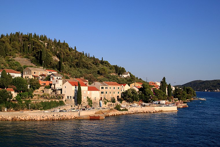
Photo: Lovro Rumiha, CC BY 2.0.
Ošljak is a Croatian island in the Adriatic Sea. Its total area is 0.3 km2 and it lies just off the Dalmatian coast between Zadar and the island of Ugljan.
Ždrelac Bridge
Bridge

Photo: Wikimedia, CC BY-SA 3.0.
The Ždrelac Bridge is a 210-metre through arch bridge carrying the D110 state road connecting islands of Ugljan and Pašman in Croatia. The original bridge was completed in 1972, however 2009 reconstruction increased the main span and widened the deck.

Places in the Area
Nearby places include Zadar and Kali.
Zadar

Photo: Böhringer, CC BY-SA 2.5.
Zadar is the biggest city, cultural, economic and transit center of northern Dalmatia and the oldest continuously inhabited city in Croatia. Zadar is today one of the most popular Croatian tourist destinations, named "entertainment center of the Adriatic" by The Times and "Croatia's new capital of cool" by The Guardian in 2017.
Kali
Village

Photo: Jean-no, CC BY-SA 3.0.
Kali is a village and the only settlement in the eponymous municipality in Croatia on Ugljan island in Zadar County. In the 2011 census, there were 1,638 inhabitants, 99.39% of whom were Croats.
Bibinje
Village

Photo: Voilierprovencal, CC BY-SA 3.0.
Bibinje is the only settlement in the eponymous municipality in southern Croatia, a suburb of Zadar, between the Adriatic tourist road and the sea, having a four-kilometer coastline with beaches and pathways.
Rt Fratašćina
- Type: Cape
- Also known as: “Rt Zaglavić”
- Category: landform
- Location: Zadar County, Croatia, Balkans, Europe
- View on OpenStreetMap
Latitude
44.0338° or 44° 2′ 2″ northLongitude
15.2188° or 15° 13′ 8″ eastOpen location code
8FPQ26M9+GGOpenStreetMap ID
node 1023641620OpenStreetMap feature
natural=cape
This page is based on OpenStreetMap, Wikidata, and Wikimedia Commons.
We’d love your help improving our open data sources. Thank you for contributing.
Satellite Map
Discover Rt Fratašćina from above in high-definition satellite imagery.
Localities in the Area
Explore places such as Kukljica and Ždrelašćica.
Notable Places Nearby
Highlights include Veli Školj and Otočić Golac.
Croatia: Must-Visit Destinations
Delve into Zagreb, Dubrovnik, Split, and Rijeka.
Curious Capes to Discover
Uncover intriguing capes from every corner of the globe.
About Mapcarta. Data © OpenStreetMap contributors and available under the Open Database License". Text is available under the CC BY-SA 4.0 license, except for photos, directions, and the map. Photo: Wikimedia, CC BY-SA 3.0.