Lower Cray’s Farm
Lower Cray’s Farm is a farm in Thakeham, Horsham District, England. Lower Cray’s Farm is situated nearby to the forest Bacon’s Land, as well as near the fishing area Pulborough Angling Society.| Tap on a place to explore it |
Places of Interest Nearby
Highlights include Church of the Holy Sepulchre and The White Lion Inn.
Church of the Holy Sepulchre
Church

Photo: Dave Spicer, CC BY-SA 2.0.
The Church of the Holy Sepulchre is a former Anglican church in the hamlet of Warminghurst in the district of Horsham, one of seven local government districts in the English county of West Sussex. Church of the Holy Sepulchre is situated 1 mile south of Lower Cray’s Farm.
The White Lion Inn
Pub
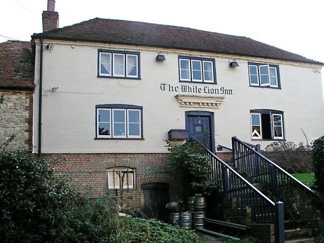
Photo: Andy Potter, CC BY-SA 2.0.
The White Lion Inn is a pub, which is situated 3,100 feet southwest of Lower Cray’s Farm.
St Mary’s Church
Church
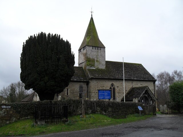
Photo: Basher Eyre, CC BY-SA 2.0.
St Mary's Church is the Grade I listed Anglican parish church of West Chiltington, a village in the Horsham district of West Sussex, England. The 12th-century building, described as a "showpiece" and "the most attractive part" of the Wealden village, retains many features of historical and architectural interest. St Mary’s Church is situated 1½ miles west of Lower Cray’s Farm.
Places in the Area
Nearby places include Thakeham and Warminghurst.
Thakeham
Village

Photo: Nuttycow, Public domain.
Thakeham is a village and civil parish located north of the South Downs in the Horsham District of West Sussex, England. The village is situated approximately 12 miles south-west of Horsham and 11 miles north of the sea-side town of Worthing.
Warminghurst
Hamlet
Warminghurst is a village and former civil parish, now in the parish of Thakeham, in the Horsham district of West Sussex, England. It lies on the Ashington to Heath Common road 2.4 miles northeast of Storrington.
West Chiltington
Village
 West Chiltington is a village and civil parish in the Horsham district of West Sussex, England. It lies on the Storrington to Broadford Bridge road, 2.6 miles north of Storrington.
Lower Cray’s Farm
- Type: Farm
- Categories: locality and agriculture
- Location: Thakeham, Horsham District, West Sussex, South East England, England, United Kingdom, Britain and Ireland, Europe
- View on OpenStreetMap
Latitude
50.95191° or 50° 57′ 7″ northLongitude
-0.41644° or 0° 24′ 59″ westOpen location code
9C2XXH2M+QCOpenStreetMap ID
node 10249604443OpenStreetMap feature
place=farm
This page is based on OpenStreetMap, Wikidata, and Wikimedia Commons.
We’d love your help improving our open data sources. Thank you for contributing.
Satellite Map
Discover Lower Cray’s Farm from above in high-definition satellite imagery.
Notable Places Nearby
Highlights include Bacon’s Land and Pulborough Angling Society.
Nearby Places
Explore places such as Crays Court (business park) and Northwood Forestry Ltd.
West Sussex: Must-Visit Destinations
Delve into Chichester, Crawley, Worthing, and Horsham.
Curious Farms to Discover
Uncover intriguing farms from every corner of the globe.
About Mapcarta. Data © OpenStreetMap contributors and available under the Open Database License". Text is available under the CC BY-SA 4.0 license, except for photos, directions, and the map. Photo: wildlife encounters, CC BY 2.0.