The Makeup & Hair Bar
The Makeup & Hair Bar is a beauty salon in Southborough, Tunbridge Wells District, England. The Makeup & Hair Bar is situated nearby to St Dunstan’s Catholic Church, as well as near St Thomas’s Church.| Tap on a place to explore it |
Places of Interest Nearby
Highlights include Church of St Peter and Christ Church.
Church of St Peter
Church

Photo: Nigel Chadwick, CC BY-SA 2.0.
Church of St Peter is situated 1,200 feet northwest of The Makeup & Hair Bar.
Christ Church
Church

Photo: The Voice of Hassocks, CC0.
Christ Church is situated 2,300 feet south of The Makeup & Hair Bar.
Mansion House
Historic building

Photo: Nigel Chadwick, CC BY-SA 2.0.
The Salomons Museum is a museum north of Tunbridge Wells, in the county of Kent, southeast England. It preserves the country house of Sir David Salomons, the first Jewish Lord Mayor of London, and of his nephew, Sir David Lionel Salomons, a scientist and engineer. Mansion House is situated 1 mile southwest of The Makeup & Hair Bar.
Places in the Area
Nearby places include Bidborough and Royal Tunbridge Wells.
Bidborough
Village
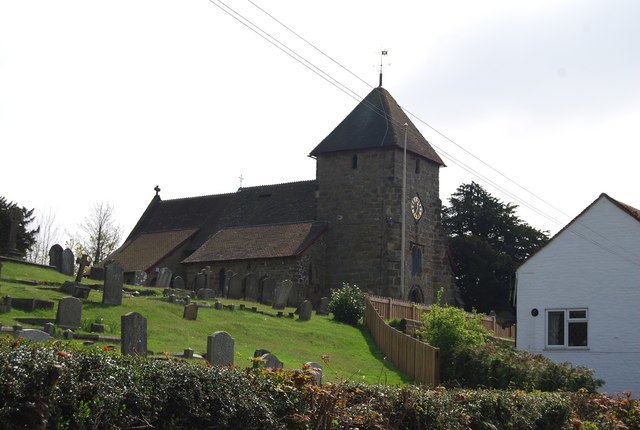
Photo: Nigel Chadwick, CC BY-SA 2.0.
Bidborough is a village and civil parish in the borough of Tunbridge Wells in Kent, England, north of Royal Tunbridge Wells and south of Tonbridge. According to the 2001 census it had a population of 958, increasing to 1,163 at the 2011 Census.
Royal Tunbridge Wells

Photo: Editor5807, CC BY-SA 3.0.
Royal Tunbridge Wells is a town in west Kent on the border with East Sussex, in the South East of England.
Speldhurst
Village
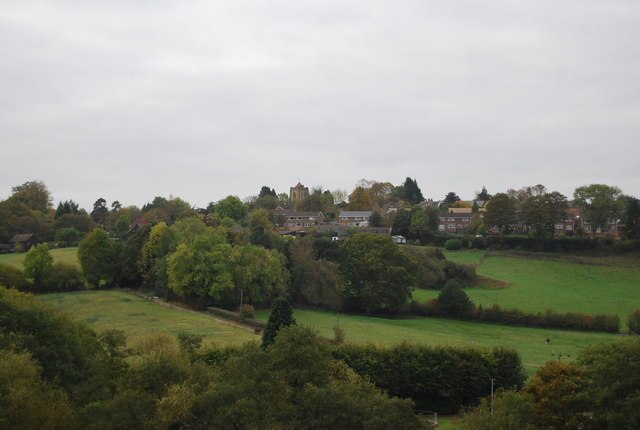
Photo: Nigel Chadwick, CC BY-SA 2.0.
Speldhurst is a village and civil parish in the borough of Tunbridge Wells in Kent, England. The parish is to the west of Tunbridge Wells: the village is 3 miles west of the town. Speldhurst is situated 2 miles west of The Makeup & Hair Bar.
The Makeup & Hair Bar
- Type: Beauty salon
- Address: 31
- Category: shop
- Location: Southborough, Tunbridge Wells District, Kent, South East England, England, United Kingdom, Britain and Ireland, Europe
- View on OpenStreetMap
Latitude
51.16129° or 51° 9′ 41″ northLongitude
0.25676° or 0° 15′ 24″ eastOpen location code
9F325764+GPOpenStreetMap ID
node 10290415789OpenStreetMap feature
shop=beauty
This page is based on OpenStreetMap, Wikidata, and Wikimedia Commons.
We’d love your help improving our open data sources. Thank you for contributing.
Satellite Map
Discover The Makeup & Hair Bar from above in high-definition satellite imagery.
Notable Places Nearby
Highlights include St Dunstan’s Catholic Church and St Thomas’s Church.
Nearby Places
Explore places such as The House Company and Window Express UK Ltd.
Kent: Must-Visit Destinations
Delve into Canterbury, Dover, Maidstone, and Rochester.
Curious Beauty Salons to Discover
Uncover intriguing beauty salons from every corner of the globe.
About Mapcarta. Data © OpenStreetMap contributors and available under the Open Database License". Text is available under the CC BY-SA 4.0 license, except for photos, directions, and the map. Photo: Diliff, CC BY-SA 3.0.