Rogers Lane South
Rogers Lane South is a bus stop in Stoke Poges, South Bucks District, England. Rogers Lane South is situated nearby to Stoke Poges Tennis Club, as well as near The Stoke Poges School.| Tap on a place to explore it |
Places of Interest Nearby
Highlights include St Andrew’s Church Centre and Stoke Poges Memorial Gardens.
St Andrew’s Church Centre
Church

Photo: Nigel Cox, CC BY-SA 2.0.
St Andrew’s Church Centre is situated 1,500 feet north of Rogers Lane South.
Stoke Poges Memorial Gardens
Garden

Photo: Gill Griffin, CC BY 2.0.
The Stoke Poges Memorial Gardens in Buckinghamshire, England are listed Grade I on the Register of Historic Parks and Gardens. They are adjacent to the Church of St Giles in the village of Stoke Poges. Stoke Poges Memorial Gardens is situated 4,000 feet southwest of Rogers Lane South.
Stoke Park
Manor estate
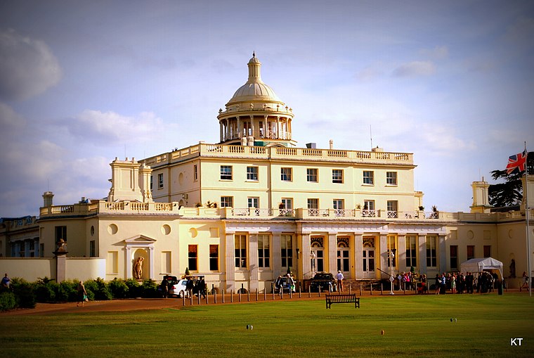
Photo: Carine06, CC BY-SA 2.0.
Stoke Park is a private sporting and leisure estate in Stoke Poges, Buckinghamshire. The mansion building is located in the middle of 300 acres of parkland, lakes, gardens and monuments. Stoke Park is situated 1 mile southwest of Rogers Lane South.
Places in the Area
Nearby places include Stoke Poges and Wexham Street.
Stoke Poges
Village

Photo: Des Blenkinsopp, CC BY-SA 2.0.
Stoke Poges is a village and civil parish in south-east Buckinghamshire, England. It is centred 3 miles north-north-east of Slough, its post town, and is 2 miles southeast of Farnham Common. In 2021, it had a population of 5,067.

Farnham Royal
Village

Photo: David Howard, CC BY-SA 2.0.
Farnham Royal is a village and civil parish within Buckinghamshire, England. It is in the south of the county, immediately north of Slough, and around 22 miles west of Charing Cross, Central London.
Rogers Lane South
- Type: Bus stop
- Category: transportation
- Location: Stoke Poges, South Bucks District, Buckinghamshire, South East England, England, United Kingdom, Britain and Ireland, Europe
- View on OpenStreetMap
Latitude
51.54338° or 51° 32′ 36″ northLongitude
-0.58765° or 0° 35′ 16″ westOpen location code
9C3XGCV6+9WOpenStreetMap ID
node 10304985932OpenStreetMap feature
highway=bus_stopOpenStreetMap feature
public_transport=platform
This page is based on OpenStreetMap, Wikidata, and Wikimedia Commons.
We’d love your help improving our open data sources. Thank you for contributing.
Satellite Map
Discover Rogers Lane South from above in high-definition satellite imagery.
Notable Places Nearby
Highlights include Stoke Poges Tennis Club and The Stoke Poges School.
Nearby Places
Explore places such as Banana Moon Day Nursery and Hitachi Data Systems.
Buckinghamshire: Must-Visit Destinations
Delve into Milton Keynes, Aylesbury, High Wycombe, and Buckingham.
Curious Bus Stops to Discover
Uncover intriguing bus stops from every corner of the globe.
About Mapcarta. Data © OpenStreetMap contributors and available under the Open Database License". Text is available under the CC BY-SA 4.0 license, except for photos, directions, and the map. Photo: Wikimedia, CC0.