Observatorio Interactivo de Hundimiento y Fracturamiento
Observatorio Interactivo de Hundimiento y Fracturamiento is a museum in Mexico City, Central Mexico which is located on Calle Colima. Observatorio Interactivo de Hundimiento y Fracturamiento is situated nearby to the park Utopía Tecoloxtitlán, as well as near the marketplace Mercado ‘San Sebastian’.| Tap on a place to explore it |
Places of Interest Nearby
Highlights include Peñón Viejo metro station and Acatitla metro station.
Peñón Viejo metro station
Metro station
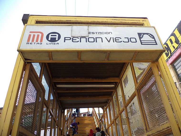
Photo: GAED, CC BY-SA 3.0.
Peñon Viejo is a station along Line A of the Mexico City Metro. It is located in the Colonia Santa Martha Acatitla Norte and Colonia Santa Martha Acatitla Sur neighborhoods of the Iztapalapa borough of Mexico City. Peñón Viejo metro station is situated 1¼ km north of Observatorio Interactivo de Hundimiento y Fracturamiento.
Acatitla metro station
Metro station

Photo: Thelmadatter, Public domain.
Acatitla is a station along Line A of the Mexico City Metro. It is an aboveground station. The station has connections to bus routes 162B, 163, 163A, 163B, 164, and 166. Service at this station began 12 August 1991. Acatitla metro station is situated 1½ km east of Observatorio Interactivo de Hundimiento y Fracturamiento.
Santa Marta metro station
Metro station

Photo: Dge, CC BY-SA 3.0.
Santa Marta is a station along Line A of the Mexico City Metro. It is located in the Colonia Ermita Zaragoza neighborhood of the Iztapalapa borough in Mexico City. The logo of the station depicts a silhouette of Saint Martha with a pitcher in her hands. Santa Marta metro station is situated 2½ km east of Observatorio Interactivo de Hundimiento y Fracturamiento.
Places in the Area
Nearby places include Santiago Acahualtepec and Los Reyes Acaquilpan.
Santiago Acahualtepec
Town
Santiago Acahualtepec is one of the natives towns in Iztapalapa, located east of Mexico City. It currently borders the town of Santa Martha Acatitla; with the colonias 1st and 2nd Ampliación of Santiago Acahualtepec, Miguel de la Madrid, Ixtlahuacán, and Lomas de Zaragoza, which were part of the farming lands of the natives of the town of Santiago.
Los Reyes Acaquilpan
Town

Photo: Ivan03, CC BY-SA 4.0.
Los Reyes Acaquilpan is a town, which is situated 4½ km east of Observatorio Interactivo de Hundimiento y Fracturamiento.
San Francisco Tlaltenco
Quarter

Photo: Emmanuel Castañeda Mendoza, CC BY-SA 4.0.
San Francisco Tlaltenco is a quarter, which is situated 7 km south of Observatorio Interactivo de Hundimiento y Fracturamiento.
Observatorio Interactivo de Hundimiento y Fracturamiento
- Type: Museum
- Address: Calle Colima
- Categories: tourism and tourist attraction
- Location: Mexico City, Central Mexico, Mexico, North America
- View on OpenStreetMap
Latitude
19.36173° or 19° 21′ 42″ northLongitude
-99.02044° or 99° 1′ 14″ westOpen location code
76F29X6H+MROpenStreetMap ID
node 10557706745OpenStreetMap feature
tourism=museum
This page is based on OpenStreetMap, Wikidata, and Wikimedia Commons.
We’d love your help improving our open data sources. Thank you for contributing.
Satellite Map
Discover Observatorio Interactivo de Hundimiento y Fracturamiento from above in high-definition satellite imagery.
Notable Places Nearby
Highlights include Utopía Tecoloxtitlán and Mercado ‘San Sebastian’.
Nearby Places
Explore places such as RAMÍREZ & ABOGADOS Despacho Jurídico and Bodega Aurrera Express.
Mexico City: Must-Visit Destinations
Delve into Centro, Xochimilco, Condesa and Roma, and Coyoacán.
Curious Museums to Discover
Uncover intriguing museums from every corner of the globe.
About Mapcarta. Data © OpenStreetMap contributors and available under the Open Database License". Text is available under the CC BY-SA 4.0 license, except for photos, directions, and the map. Photo: Wikimedia, CC BY 2.0.