Blurton - Trentham Road
Blurton - Trentham Road is in Stoke-on-Trent, England. Blurton - Trentham Road is situated nearby to the pitch Hem Heath Crown Green Bowls Club, as well as near Longton Cricket Club Ground.| Tap on a place to explore it |
Places of Interest Nearby
Highlights include Longton Cricket Club Ground and Church of St Bartholomew.
Longton Cricket Club Ground
Pitch
Longton Cricket Club Ground is a cricket ground in Stoke-on-Trent, Staffordshire. The first recorded match on the ground was in 1954, when Staffordshire played Northumberland in the grounds first Minor Counties Championship match. Longton Cricket Club Ground is situated 510 feet west of Blurton - Trentham Road.
Church of St Bartholomew
Church

Photo: Geoff Pick, CC BY-SA 2.0.
Church of St Bartholomew is situated 1,000 feet north of Blurton - Trentham Road.
St Paul’s
Church
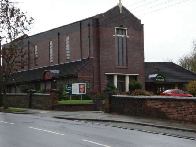
Photo: Steven Birks, CC BY-SA 2.0.
St Paul’s is a church, which is situated 4,200 feet north of Blurton - Trentham Road.
Places in the Area
Nearby places include Longton and Meir.
Longton
Town

Photo: www fotodiscs4u co uk, CC BY-SA 2.0.
Longton is one of the six towns which amalgamated to form the county borough of Stoke-on-Trent in 1910, along with Hanley, Tunstall, Fenton, Burslem and Stoke-upon-Trent in Staffordshire, England.
Meir
Suburb

Photo: AtticTapestry, CC BY-SA 4.0.
Meir is a suburb in Stoke-on-Trent, Staffordshire situated between Lightwood and Longton. Meir Park estate extends from Meir uphill to the Meir Heath and Rough Close village hall, located in Meir Heath. Meir is situated 2 miles east of Blurton - Trentham Road.
Fenton
Town
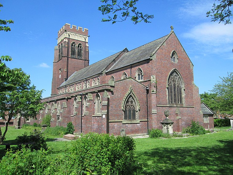
Photo: AtticTapestry, CC BY-SA 4.0.
Fenton is one of the six towns that amalgamated with Hanley, Tunstall, Burslem, Longton and Stoke-upon-Trent to form the county borough of Stoke-on-Trent in 1910, later raised to city status in 1925. Fenton is situated 2 miles north of Blurton - Trentham Road.
Blurton - Trentham Road
- Type: Map
- Categories: information and tourism
- Location: Stoke-on-Trent, England, United Kingdom, Britain and Ireland, Europe
- View on OpenStreetMap
Latitude
52.97154° or 52° 58′ 18″ northLongitude
-2.15128° or 2° 9′ 5″ westBrand
Legible LondonOperator
Stoke-on-Trent City CouncilOpen location code
9C4VXRCX+JFOpenStreetMap ID
node 10563316519OpenStreetMap feature
tourism=information
This page is based on OpenStreetMap, Wikidata, and Wikimedia Commons.
We’d love your help improving our open data sources. Thank you for contributing.
Satellite Map
Discover Blurton - Trentham Road from above in high-definition satellite imagery.
Notable Places Nearby
Highlights include Hem Heath Crown Green Bowls Club and Mill Pond.
Nearby Places
Explore places such as The Gables and Douglas Macmillan Hospice.
England: Must-Visit Destinations
Delve into London, Manchester, Sheffield, and Leeds.
Curious Places to Discover
Uncover intriguing places from every corner of the globe.
About Mapcarta. Data © OpenStreetMap contributors and available under the Open Database License". Text is available under the CC BY-SA 4.0 license, except for photos, directions, and the map. Photo: Leereyno, CC BY-SA 3.0.