Ferryhill Commercial Waste Depot
Ferryhill Commercial Waste Depot is a transfer station in Cornforth, County Durham, England. Ferryhill Commercial Waste Depot is situated nearby to the nature reserve Bishop Middleham Quarry, as well as near the hamlet Garmondsway.| Tap on a place to explore it |
Places of Interest Nearby
Highlights include Bishop Middleham Quarry and Fishburn.
Bishop Middleham Quarry
Nature reserve
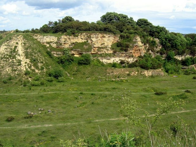
Photo: Andrew Curtis, CC BY-SA 2.0.
Bishop Middleham Quarry is a disused quarry, about 4 kilometres north-west of Sedgefield, County Durham, England. Quarry-working here ceased in 1934, and the site has since been colonised by vegetation.
Fishburn
Aerodrome
Fishburn Airfield is a small grass strip airfield in Fishburn, County Durham. The airfield was opened on 30 June 1995 by the then local MP and Leader of the Opposition Tony Blair.
Coxhoe War Memorial
Memorial
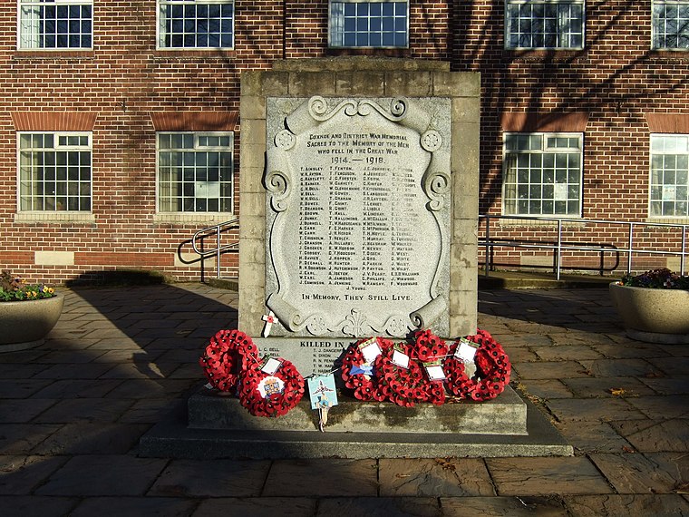
Photo: JThomas, CC BY-SA 2.0.
Coxhoe War Memorial is situated 1½ miles northwest of Ferryhill Commercial Waste Depot.
Places in the Area
Nearby places include Garmondsway and Cornforth.
Garmondsway
Hamlet
Garmondsway is a small dispersed hamlet in the parish of Kelloe in County Durham, England situated between Durham and Sedgefield. It is notable as including substantial remains of an abandoned village including an extant ridge and furrow field system and became a scheduled monument in 1957.
Cornforth
Village

Photo: Oliver Dixon, CC BY-SA 2.0.
Cornforth is a village in County Durham, England. It is adjacent to the village of West Cornforth, situated a short distance to the north-east of Ferryhill.
Bishop Middleham
Village
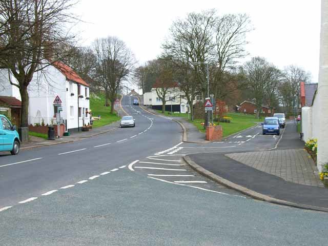
Photo: Oliver Dixon, CC BY-SA 2.0.
Bishop Middleham is a village in County Durham, in England. The population of the parish as taken at the 2011 census was 1,275 It is close to Sedgefield.
Ferryhill Commercial Waste Depot
- Type: Transfer station
- Address: West Cornforth, Ferryhill, DL17 9DT
- Category: industry
- Location: Cornforth, County Durham, North East England, England, United Kingdom, Britain and Ireland, Europe
- View on OpenStreetMap
Latitude
54.69814° or 54° 41′ 53″ northLongitude
-1.48437° or 1° 29′ 4″ westOperator
VeoliaOpen location code
9C6WMGX8+77OpenStreetMap ID
node 10577366593OpenStreetMap feature
amenity=waste_transfer_station
This page is based on OpenStreetMap, Wikidata, and Wikimedia Commons.
We’d love your help improving our open data sources. Thank you for contributing.
Satellite Map
Discover Ferryhill Commercial Waste Depot from above in high-definition satellite imagery.
Notable Places Nearby
Highlights include Garmondsway Medieval Village and Spennymoor and District Clay Pigeon Club.
Nearby Places
Explore places such as Wm McIvor & Son and Hare & Hounds P.H..
County Durham: Must-Visit Destinations
Delve into Durham, Darlington, Hartlepool, and Stockton-on-Tees.
Curious Transfer Stations to Discover
Uncover intriguing transfer stations from every corner of the globe.
About Mapcarta. Data © OpenStreetMap contributors and available under the Open Database License". Text is available under the CC BY-SA 4.0 license, except for photos, directions, and the map. Photo: Roberto Strauss, CC BY 2.0.