Osiedle Polna II
Osiedle Polna II is a neighborhood in Gmina Sochaczew, Sochaczew County, Mazowieckie. Osiedle Polna II is situated nearby to the neighborhood Osiedle Polna V, as well as near Adamówka.| Tap on a place to explore it |
Places of Interest
Highlights include Church of the Nativity of the Virgin Mary in Sochaczew and Muzeum Ziemi Sochaczewskiej i Pola Bitwy nad Bzurą.

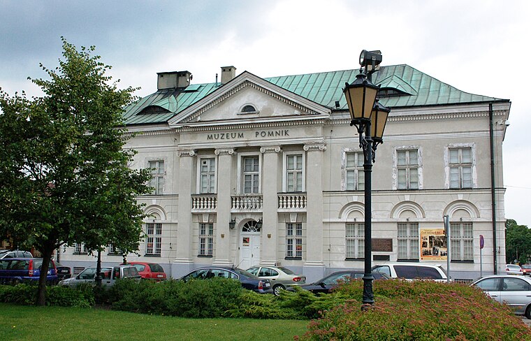
Muzeum Ziemi Sochaczewskiej i Pola Bitwy nad Bzurą
Museum

Photo: Przykuta, CC BY-SA 4.0.
Muzeum Ziemi Sochaczewskiej i Pola Bitwy nad Bzurą is a museum.

Places in the Area
Nearby places include Sochaczew and Karwowo.
Sochaczew
Town
 Sochaczew is a town in central Poland, with 33,456 inhabitants. In the Masovian Voivodeship, formerly in Skierniewice Voivodeship. It is the capital of Sochaczew County and is located approximately 50 km west from the capital of Poland Warsaw Sochaczew has a narrow-gauge railway museum with a line that runs as far as Wilcze Tułowskie.
Karwowo
Village
Karwowo is a village in the administrative district of Gmina Sochaczew, within Sochaczew County, Masovian Voivodeship, in east-central Poland. It lies approximately 1 km north of Sochaczew and 52 km west of Warsaw.
Czerwonka-Parcel
Village

Photo: Andrzej Błaszczak, CC BY-SA 4.0.
Czerwonka-Parcel is a village in the administrative district of Gmina Sochaczew, within Sochaczew County, Masovian Voivodeship, in east-central Poland.
Osiedle Polna II
- Type: Neighborhood
- Category: locality
- Location: Gmina Sochaczew, Sochaczew County, Mazowieckie, Poland, Central Europe, Europe
- View on OpenStreetMap
Latitude
52.23729° or 52° 14′ 14″ northLongitude
20.25038° or 20° 15′ 1″ eastOpen location code
9G4267P2+W5OpenStreetMap ID
node 10739842970OpenStreetMap feature
place=neighbourhood
This page is based on OpenStreetMap, Wikidata, and Wikimedia Commons.
We’d love your help improving our open data sources. Thank you for contributing.
Satellite Map
Discover Osiedle Polna II from above in high-definition satellite imagery.
Localities in the Area
Explore places such as Osiedle Polna V and Osiedle Polna III.
Notable Places Nearby
Highlights include Cmentarz parafialny and Cmentarz z II wojny światowej.
Mazowieckie: Must-Visit Destinations
Delve into Warsaw, Radom, Śródmieście, and Płock.
Curious Neighborhoods to Discover
Uncover intriguing neighborhoods from every corner of the globe.
About Mapcarta. Data © OpenStreetMap contributors and available under the Open Database License". Text is available under the CC BY-SA 4.0 license, except for photos, directions, and the map. Photo: Sicherlich, CC BY 3.0.