91.1 iFM Naga
91.1 iFM Naga is a recording studio in Municipality of Milao, Camarines Sur, Bicol which is located on Maharlika Highway. 91.1 iFM Naga is situated nearby to the town Milaor, as well as near Minalabac.| Tap on a place to explore it |
Places of Interest Nearby
Highlights include Milaor Church and Naga station.
Milaor Church
Church

Photo: Wikimedia, CC BY-SA 4.0.
Saint Joseph the Worker Parish Church, commonly known as Milaor Church, is a Roman Catholic church located in Milaor, Camarines Sur, Philippines. It is under the jurisdiction of the Diocese of Libmanan. Milaor Church is situated 1¼ km northeast of 91.1 iFM Naga.
Naga station
Railway station

Photo: Bahalanakami, CC BY-SA 3.0.
Naga station is a railway station located on the South Main Line in Naga, Camarines Sur, Philippines. It is a major station on the line, serving as the main terminus for the Bicol Commuter, Bicol Express train services and the end station for the Isarog Limited Express. Naga station is situated 4 km northeast of 91.1 iFM Naga.
Places in the Area
Nearby places include Milaor and Minalabac.
Milaor
Town

Photo: Ringer, CC BY-SA 3.0.
Milaor, officially the Municipality of Milaor, is a municipality in the province of Camarines Sur, Philippines. According to the 2020 census, it has a population of 33,963 people.
Minalabac
Town

Photo: Ringer, CC BY-SA 3.0.
Minalabac, officially the Municipality of Minalabac, is a First Class municipality in the province of Camarines Sur, Philippines. According to the 2020 census, it has a population of 53,981 people. Minalabac is situated 2½ km southeast of 91.1 iFM Naga.
Camaligan
Town
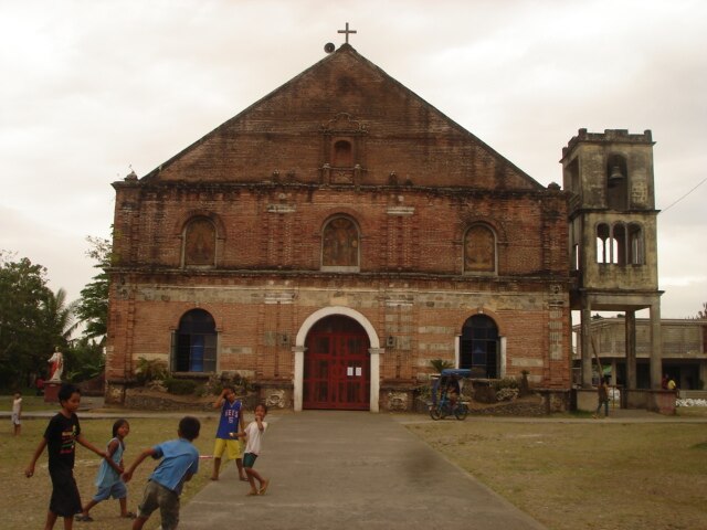
Photo: Ringer, CC BY-SA 3.0.
Camaligan, officially the Municipality of Camaligan, is a municipality in the province of Camarines Sur, Philippines. According to the 2020 census, it has a population of 25,036 people. Camaligan is situated 3½ km north of 91.1 iFM Naga.
91.1 iFM Naga
- Type: Recording studio
- Address: Maharlika Highway, Milaor, 4413
- Location: Municipality of Milao, Camarines Sur, Bicol, Luzon, Philippines, Southeast Asia, Asia
- View on OpenStreetMap
Latitude
13.58854° or 13° 35′ 19″ northLongitude
123.16935° or 123° 10′ 10″ eastOpen location code
7Q55H5Q9+CPOpenStreetMap ID
node 10749646892OpenStreetMap feature
amenity=studio
This page is based on OpenStreetMap, Wikidata, and Wikimedia Commons.
We’d love your help improving our open data sources. Thank you for contributing.
Satellite Map
Discover 91.1 iFM Naga from above in high-definition satellite imagery.
Notable Places Nearby
Highlights include Milaor Bridge № 1 and The Church of Jesus Christ of Latter-day Saints.
Nearby Places
Explore places such as RMN Broadcasting Center and DWNX 1511 Naga.
Camarines Sur: Must-Visit Destinations
Delve into Naga, Iriga, Pili, and Calabanga.
Curious Recording Studios to Discover
Uncover intriguing recording studios from every corner of the globe.
About Mapcarta. Data © OpenStreetMap contributors and available under the Open Database License". Text is available under the CC BY-SA 4.0 license, except for photos, directions, and the map. Photo: Wikimedia, CC0.