Lahori Kulfi & Falooda
Lahori Kulfi & Falooda is a café in Redbridge, Greater London, England which is located on Ilford Lane. Lahori Kulfi & Falooda is situated nearby to Clementswood Baptist Church, as well as near Cleveland Road Primary School.| Tap on a place to explore it |
Places of Interest Nearby
Highlights include Ilford railway station and St Alban’s Church, Ilford.
Ilford railway station
Railway station
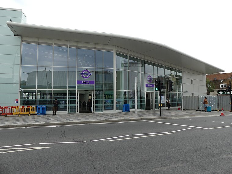
Photo: Sunil060902, CC BY-SA 4.0.
Ilford railway station is on the Great Eastern Main Line serving the town of Ilford in the London Borough of Redbridge, east London. It is 7 miles 29 chains down the line from London Liverpool Street and is situated between Manor Park and Seven Kings. Ilford railway station is situated 2,000 feet northwest of Lahori Kulfi & Falooda.
St Alban’s Church, Ilford
Church

Photo: John Salmon, CC BY-SA 2.0.
St Alban's Church, Ilford, is a Church of England church and parish in Ilford, part of the London Borough of Redbridge. It began as a temporary building, replaced by a permanent Neo-Gothic redbrick one on Albert Road built between 1900 and 1906. St Alban’s Church, Ilford is situated 1,200 feet northeast of Lahori Kulfi & Falooda.
Redbridge Museum
Museum

Photo: JuliaC2006, CC BY 2.0.
Redbridge Museum is situated 1,600 feet northeast of Lahori Kulfi & Falooda.
Places in the Area
Nearby places include Ilford and Little Ilford.
Ilford
Town

Photo: Sunil060902, CC BY-SA 3.0.
Ilford is a large town in East London, England, 9 miles northeast of Charing Cross. Part of the London Borough of Redbridge, Ilford is within the ceremonial county of Greater London.
Little Ilford
Suburb

Photo: John Salmon, CC BY-SA 2.0.
Little Ilford is a district of London, England in the London Borough of Newham. It gives its name to the Little Ilford ward.
Loxford
Quarter

Photo: Robert Edwards, CC BY-SA 2.0.
Loxford is an area of Ilford in the London Borough of Redbridge in east London, UK. It is a built-up, multi-ethnic locality.
Lahori Kulfi & Falooda
- Type: Café
- Address: 112b Ilford Lane, Ilford, IG1 2LD
- Location: Redbridge, Greater London, England, United Kingdom, Britain and Ireland, Europe
- View on OpenStreetMap
Latitude
51.554° or 51° 33′ 14″ northLongitude
0.07264° or 0° 4′ 22″ eastOpen location code
9F32H33F+J3OpenStreetMap ID
node 10771841570OpenStreetMap feature
amenity=cafe
This page is based on OpenStreetMap, Wikidata, and Wikimedia Commons.
We’d love your help improving our open data sources. Thank you for contributing.
Satellite Map
Discover Lahori Kulfi & Falooda from above in high-definition satellite imagery.
Notable Places Nearby
Highlights include Clementswood Baptist Church and Cleveland Road Primary School.
Nearby Places
Explore places such as Amir Boutique and Cakes and Bakes.
England: Must-Visit Destinations
Delve into London, Manchester, Sheffield, and Leeds.
Curious Cafés to Discover
Uncover intriguing cafés from every corner of the globe.
About Mapcarta. Data © OpenStreetMap contributors and available under the Open Database License". Text is available under the CC BY-SA 4.0 license, except for photos, directions, and the map. Photo: sidibousaid, CC BY 2.0.