PILARES Campestre Potrero
PILARES Campestre Potrero is a community center in Mexico State, Central Mexico which is located on Camino Real. PILARES Campestre Potrero is situated nearby to the pitch Parque Deportivo Huitzico, as well as near Parroquia San Martín Obispo de Tours.| Tap on a place to explore it |
Places of Interest Nearby
Highlights include Tetlalmanche Volcano and La Paz metro station.
Tetlalmanche Volcano
Volcano

Photo: Yavidaxiu, CC BY-SA 3.0.
Tetlalmanche Volcano is situated 3 km west of PILARES Campestre Potrero.
La Paz metro station
Metro station
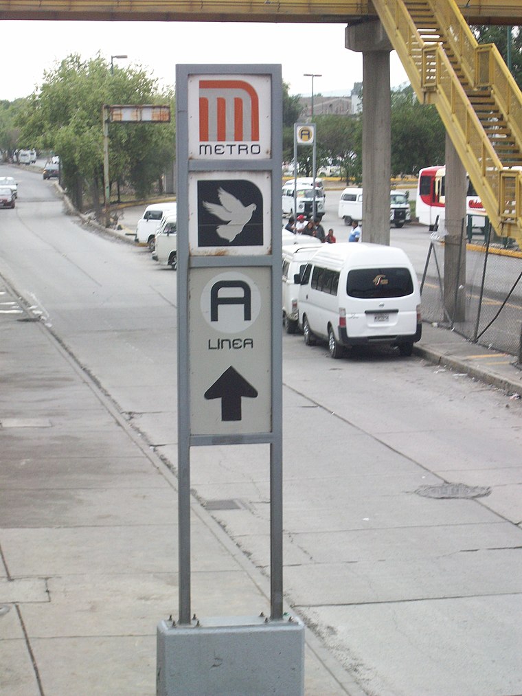 La Paz is a Mexico City Metro station that serves Line A. It is the line's terminal station. It opened, along with the other stations along Line A, on 12 August 1991. La Paz metro station is situated 3 km northeast of PILARES Campestre Potrero.
Los Reyes metro station
Metro station

Photo: Dge, CC BY-SA 3.0.
Los Reyes is a street-level station along Line A of the Mexico City Metro. It is located in the Colonia Los Reyes Acaquilpan neighborhood in La Paz municipio in the State of Mexico adjacent to Mexico City. Los Reyes metro station is situated 3½ km north of PILARES Campestre Potrero.
Places in the Area
Nearby places include Santa Catarina Yecahuízotl and Los Reyes Acaquilpan.

Los Reyes Acaquilpan
Town

Photo: Ivan03, CC BY-SA 4.0.
Los Reyes Acaquilpan is a town, which is situated 3½ km north of PILARES Campestre Potrero.
Santiago Acahualtepec
Town
Santiago Acahualtepec is one of the natives towns in Iztapalapa, located east of Mexico City. It currently borders the town of Santa Martha Acatitla; with the colonias 1st and 2nd Ampliación of Santiago Acahualtepec, Miguel de la Madrid, Ixtlahuacán, and Lomas de Zaragoza, which were part of the farming lands of the natives of the town of Santiago. Santiago Acahualtepec is situated 4½ km northwest of PILARES Campestre Potrero.
PILARES Campestre Potrero
- Type: Community center
- Address: Camino Real
- Location: Mexico State, Central Mexico, Mexico, North America
- View on OpenStreetMap
Latitude
19.32617° or 19° 19′ 34″ northLongitude
-98.97328° or 98° 58′ 24″ westOpen location code
76F382GG+FMOpenStreetMap ID
node 10825602635OpenStreetMap feature
amenity=community_centre
This page is based on OpenStreetMap, Wikidata, and Wikimedia Commons.
We’d love your help improving our open data sources. Thank you for contributing.
Satellite Map
Discover PILARES Campestre Potrero from above in high-definition satellite imagery.
Notable Places Nearby
Highlights include Campestre Potrero and Parque Deportivo Huitzico.
Nearby Places
Explore places such as Hercab and Escuela Primaria Xiuhzitzquili.
Mexico State: Must-Visit Destinations
Delve into Tequixquiac, Toluca, Teotihuacan, and Ecatepec.
Curious Community Centers to Discover
Uncover intriguing community centers from every corner of the globe.
About Mapcarta. Data © OpenStreetMap contributors and available under the Open Database License". Text is available under the CC BY-SA 4.0 license, except for photos, directions, and the map. Photo: Wikimedia, CC0.