Kalingapatnam Bus Stop
Kalingapatnam Bus Stop is a bus stop in Gara, Srikakulam district, Andhra Pradesh. Kalingapatnam Bus Stop is situated nearby to Kalingapatnam Lighthouse, as well as near the village Polaki.| Tap on a place to explore it |
Places of Interest Nearby
Highlights include Kalingapatnam Lighthouse.
Kalingapatnam Lighthouse
Lighthouse
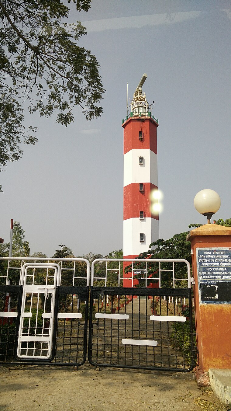
Photo: రహ్మానుద్దీన్, CC BY-SA 4.0.
Kalingapatnam Lighthouse is situated 450 metres southeast of Kalingapatnam Bus Stop.
Places in the Area
Nearby places include Kalingapatnam and Polaki.
Kalingapatnam
Village
 Kalingapatnam is a village in Srikakulam district of the Indian state of Andhra Pradesh. It is located in Gara mandal of Srikakulam revenue division. It has one of the major beach sand deposits of the state.
Polaki
Village
Polaki is a village in Srikakulam district of Andhra Pradesh in India. It is the Mandal headquarters of Polaki Mandal. Polaki is situated 3½ km northwest of Kalingapatnam Bus Stop.
Gara
Village
Gara is a village in Srikakulam district of the Indian state of Andhra Pradesh. It is also the mandal headquarters of Gara Mandal, Srikakulam District, AP. Gara is situated 7 km west of Kalingapatnam Bus Stop.
Kalingapatnam Bus Stop
- Type: Bus stop
- Category: transportation
- Location: Gara, Srikakulam district, Andhra Pradesh, Southern India, India, South Asia, Asia
- View on OpenStreetMap
Latitude
18.34231° or 18° 20′ 32″ northLongitude
84.11802° or 84° 7′ 5″ eastOpen location code
7MC684R9+W6OpenStreetMap ID
node 10837784441OpenStreetMap feature
highway=bus_stopOpenStreetMap feature
public_transport=platform
This page is based on OpenStreetMap, Wikidata, and Wikimedia Commons.
We’d love your help improving our open data sources. Thank you for contributing.
Satellite Map
Discover Kalingapatnam Bus Stop from above in high-definition satellite imagery.
Notable Places Nearby
Highlights include BANDARUVANIPETA BUS STOP and Police Quarters.
Nearby Places
Explore places such as PHC,Gara and Primary Health Centre, Calingapatnam.
Andhra Pradesh: Must-Visit Destinations
Delve into Visakhapatnam, Vijayawada, Guntur, and Tirupati.
Curious Bus Stops to Discover
Uncover intriguing bus stops from every corner of the globe.
About Mapcarta. Data © OpenStreetMap contributors and available under the Open Database License". Text is available under the CC BY-SA 4.0 license, except for photos, directions, and the map. Photo: Inkey, CC BY-SA 3.0.