Mini & Moi
Mini & Moi is a baby goods shop in Knutsford, Cheshire East, England. Mini & Moi is situated nearby to the museum Knutsford Heritage Centre, as well as near the health club Anytime Fitness.| Tap on a place to explore it |
Places of Interest Nearby
Highlights include St John the Baptist’s Church, Knutsford and Knutsford railway station.
St John the Baptist’s Church, Knutsford
Church

Photo: Stefan.p21, CC BY-SA 4.0.
St John the Baptist's Church is in the town of Knutsford, Cheshire, England. The church is recorded in the National Heritage List for England as a designated Grade II* listed building. St John the Baptist’s Church, Knutsford is situated 1,000 feet southeast of Mini & Moi.
Knutsford railway station
Railway station
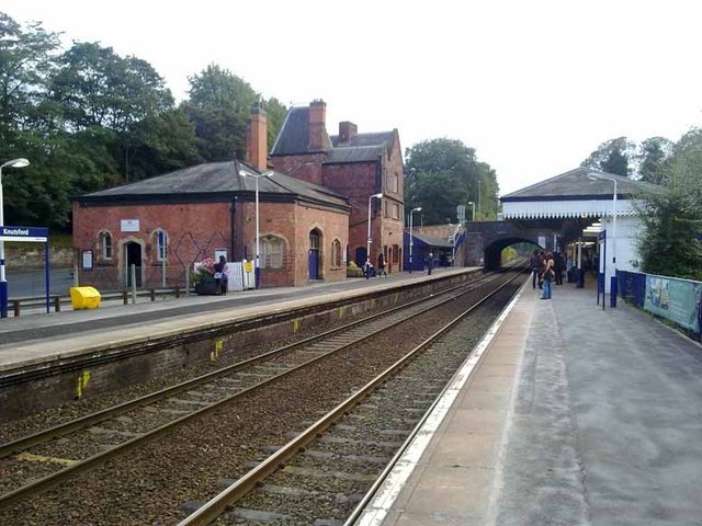
Photo: Glyn Baker, CC BY-SA 2.0.
Knutsford railway station serves the town of Knutsford in Cheshire, England. The station is 21+3⁄4 miles south of Manchester Piccadilly on the Mid-Cheshire Line to Chester. Knutsford railway station is situated 1,600 feet south of Mini & Moi.
Governor’s House, Knutsford
Public building

Photo: Dave.Dunford, CC BY-SA 4.0.
The former Governor's House is located in Toft Road, Knutsford, Cheshire, England. It was built for the governor of Knutsford Gaol, and has later been used as a Tourist Information Centre. Governor’s House, Knutsford is situated 1,500 feet south of Mini & Moi.
Places in the Area
Nearby places include Lostock Gralam and Chorley.
Lostock Gralam
Village

Photo: Ian Warburton, CC BY-SA 2.0.
Lostock Gralam is a village and civil parish in Cheshire West and Chester, Cheshire, England; it is sited east of Northwich. The civil parish also includes the small hamlet of Lostock Green. At the 2011 census, the population was 2,298. Lostock Gralam is situated 4½ miles southwest of Mini & Moi.
Chorley
Village

Photo: michael ely, CC BY-SA 2.0.
Chorley is a civil parish in the borough of Cheshire East in Cheshire, England. The parish is named after the village of Chorley, which was renamed Alderley Edge during the 19th century. Chorley is situated 4½ miles east of Mini & Moi.
Lach Dennis
Village

Photo: Ian Warburton, CC BY-SA 2.0.
Lach Dennis is a village in the civil parish of Lach Dennis and Lostock Green, in the unitary authority area of Cheshire West and Chester and the ceremonial county of Cheshire, England. Lach Dennis is situated 5 miles southwest of Mini & Moi.
Mini & Moi
- Type: Baby goods shop
- Category: shop
- Location: Knutsford, Cheshire East, England, United Kingdom, Britain and Ireland, Europe
- View on OpenStreetMap
Latitude
53.3056° or 53° 18′ 20″ northLongitude
-2.37465° or 2° 22′ 29″ westOpen location code
9C5V8J4G+64OpenStreetMap ID
node 10860387745OpenStreetMap feature
shop=baby_goods
This page is based on OpenStreetMap, Wikidata, and Wikimedia Commons.
We’d love your help improving our open data sources. Thank you for contributing.
Satellite Map
Discover Mini & Moi from above in high-definition satellite imagery.
Notable Places Nearby
Highlights include Knutsford Heritage Centre and Anytime Fitness.
Nearby Places
Explore places such as King & Allen and Oliver Wild.
England: Must-Visit Destinations
Delve into London, Manchester, Sheffield, and Leeds.
Curious Baby Goods Shops to Discover
Uncover intriguing baby goods shops from every corner of the globe.
About Mapcarta. Data © OpenStreetMap contributors and available under the Open Database License". Text is available under the CC BY-SA 4.0 license, except for photos, directions, and the map. Photo: flashcurd, CC BY 2.0.