Finca Taijara
Finca Taijara is a locality in Caldas Department, Colombia. Finca Taijara is situated nearby to the locality Entrada al Manzanillo, as well as near the village El Manzanillo.| Tap on a place to explore it |
Places in the Area
Nearby places include Chinchiná and Santa Rosa de Cabal.
Chinchiná
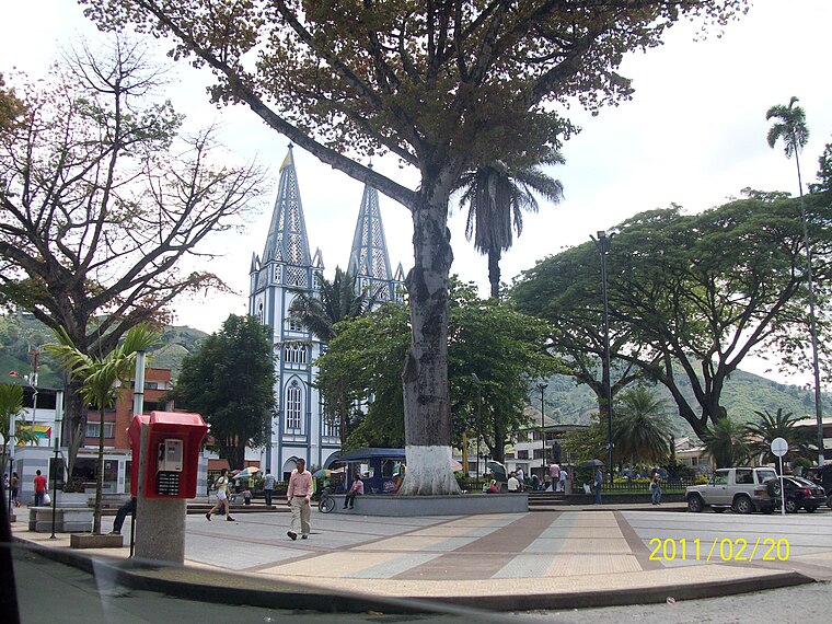
Photo: Azsxdcfvgbhnjm, CC BY 3.0.
Chinchiná, a town in the Zona Cafetera, is known as the heart of Colombian coffee. It is settled in a valley surrounded by coffee plantations. The town is home to the Buendia coffee factory and Cenicafe, a coffee research centre.
Santa Rosa de Cabal

Photo: Wikimedia, CC BY-SA 2.5.
Santa Rosa de Cabal is a town and municipality in the department of Risaralda, in Colombia's Zona Cafetera, on the western slopes of the Andean Cordillera Central.
Marsella
Town

Photo: Adrimarg, CC BY-SA 3.0.
Marsella or Marseille is a town and municipality in the Department of Risaralda in Colombia. About 30 km away from the capital Pereira. In 2023 the town had an estimated population of 17,208. Marsella is situated 10 km west of Finca Taijara.
Finca Taijara
- Type: Locality
- Location: Caldas Department, Colombia, South America
- View on OpenStreetMap
Latitude
4.93108° or 4° 55′ 52″ northLongitude
-75.65081° or 75° 39′ 3″ westOpen location code
67P6W8JX+CMOpenStreetMap ID
node 10899754074OpenStreetMap feature
place=locality
This page is based on OpenStreetMap, Wikidata, and Wikimedia Commons.
We’d love your help improving our open data sources. Thank you for contributing.
Satellite Map
Discover Finca Taijara from above in high-definition satellite imagery.
Localities in the Area
Explore places such as Entrada al Manzanillo and El Manzanillo.
Notable Places Nearby
Highlights include Asentamiento and Asentamiento.
Colombia: Must-Visit Destinations
Delve into Bogotá, Medellín, Cali, and Cartagena.
Curious Localities to Discover
Uncover intriguing localities from every corner of the globe.
About Mapcarta. Data © OpenStreetMap contributors and available under the Open Database License". Text is available under the CC BY-SA 4.0 license, except for photos, directions, and the map. Photo: jhoudayer, CC BY-SA 2.0.