Sabbat des sorcières
Sabbat des sorcières is a work of art in Ellezelles, Arrondissement of Ath, Wallonia. Sabbat des sorcières is situated nearby to the town hall Administration communale d’Ellezelles, as well as near the police station Proximité d’Ellezelles.| Tap on a place to explore it |
Places of Interest Nearby
Highlights include Pyreneeën-Tombele and Kanarieberg.
Pyreneeën-Tombele
Nature reserve

Photo: FrDr, CC BY-SA 4.0.
Pyreneeën-Tombele is a nature reserve, which is situated 3 km west of Sabbat des sorcières.
Kanarieberg
Peak

Photo: Jaribi, CC BY-SA 4.0.
Kanarieberg is the name of a road and hill in the municipality of Ronse, in the Belgian province of East Flanders. With its top at 131 m, it is one of the many hills in the Flemish Ardennes, located in the heart of the hill region. Kanarieberg is situated 4 km northwest of Sabbat des sorcières.
Pottelberg
Peak

Photo: FrDr, CC BY-SA 4.0.
Pottelberg is a peak, which is situated 4 km north of Sabbat des sorcières.
Places in the Area
Nearby places include La Houppe and Wodecq.
La Houppe
Hamlet
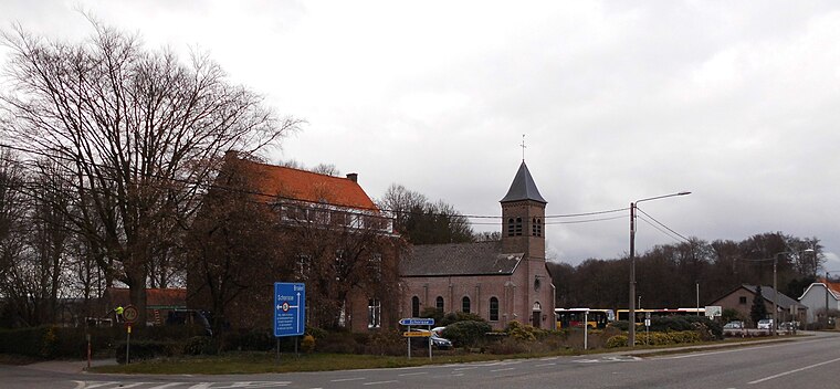
Photo: Spotter2, CC BY-SA 4.0.
La Houppe is a hamlet, which is situated 4½ km northeast of Sabbat des sorcières.
Wodecq
Village

Photo: Jean-Pol GRANDMONT, CC BY-SA 3.0.
Wodecq is a village, which is situated 5 km east of Sabbat des sorcières.
Lahamaide
Village

Photo: Herpoel, CC BY-SA 4.0.
Lahamaide, also known as La Hamaide, is a village in Wallonia, Belgium, located in the municipality of Ellezelles, Hainaut Province. It was the place of birth of Lamoral, Count of Egmont, who was born at the Château de Lahamaide in 1522. Lahamaide is situated 5 km southeast of Sabbat des sorcières.
Sabbat des sorcières
- Type: Work of art
- Artwork type: mural
- Category: tourism
- Location: Ellezelles, Arrondissement of Ath, Hainaut, Wallonia, Belgium, Benelux, Europe
- View on OpenStreetMap
Latitude
50.73225° or 50° 43′ 56″ northLongitude
3.68298° or 3° 40′ 59″ eastOpen location code
9F25PMJM+V5OpenStreetMap ID
node 10942274711OpenStreetMap feature
tourism=artworkOpenStreetMap attribute
artwork_type=mural
This page is based on OpenStreetMap, Wikidata, and Wikimedia Commons.
We’d love your help improving our open data sources. Thank you for contributing.
Satellite Map
Discover Sabbat des sorcières from above in high-definition satellite imagery.
Notable Places Nearby
Highlights include Administration communale d’Ellezelles and Proximité d’Ellezelles.
Nearby Places
Explore places such as Ellezelles Pont and La Marmite.
Hainaut: Must-Visit Destinations
Delve into Charleroi, Mons, Tournai, and La Louvière.
Curious Work Of Arts to Discover
Uncover intriguing work of arts from every corner of the globe.
About Mapcarta. Data © OpenStreetMap contributors and available under the Open Database License". Text is available under the CC BY-SA 4.0 license, except for photos, directions, and the map. Photo: Jean-Pol GRANDMONT, CC BY-SA 3.0.