Phyllis Ellman Trailhead Parking
Phyllis Ellman Trailhead Parking is a parking area in Marin County, California. Phyllis Ellman Trailhead Parking is situated nearby to San Clemente Park, as well as near the nature reserve Ring Mountain Open Space Preserve.| Tap on a place to explore it |
Places of Interest Nearby
Highlights include San Quentin Rehabilitation Center and Ring Mountain.
San Quentin Rehabilitation Center
Prison

Photo: Frank Schulenburg, CC BY-SA 4.0.
San Quentin Rehabilitation Center, formerly known as San Quentin State Prison, is a California Department of Corrections and Rehabilitation state prison for men, located north of San Francisco in the unincorporated place of San Quentin in Marin County. San Quentin Rehabilitation Center is situated 1¼ miles north of Phyllis Ellman Trailhead Parking.
Ring Mountain
Peak

Photo: Eric in SF, CC BY-SA 3.0.
Ring Mountain is an elevated landform on the Tiburon Peninsula in Marin County, California. This mountain was named for George E. Ring, who served as a Marin County Supervisor from 1895 to 1903.
Benjamin and Hilarita Lyford House
Historic building
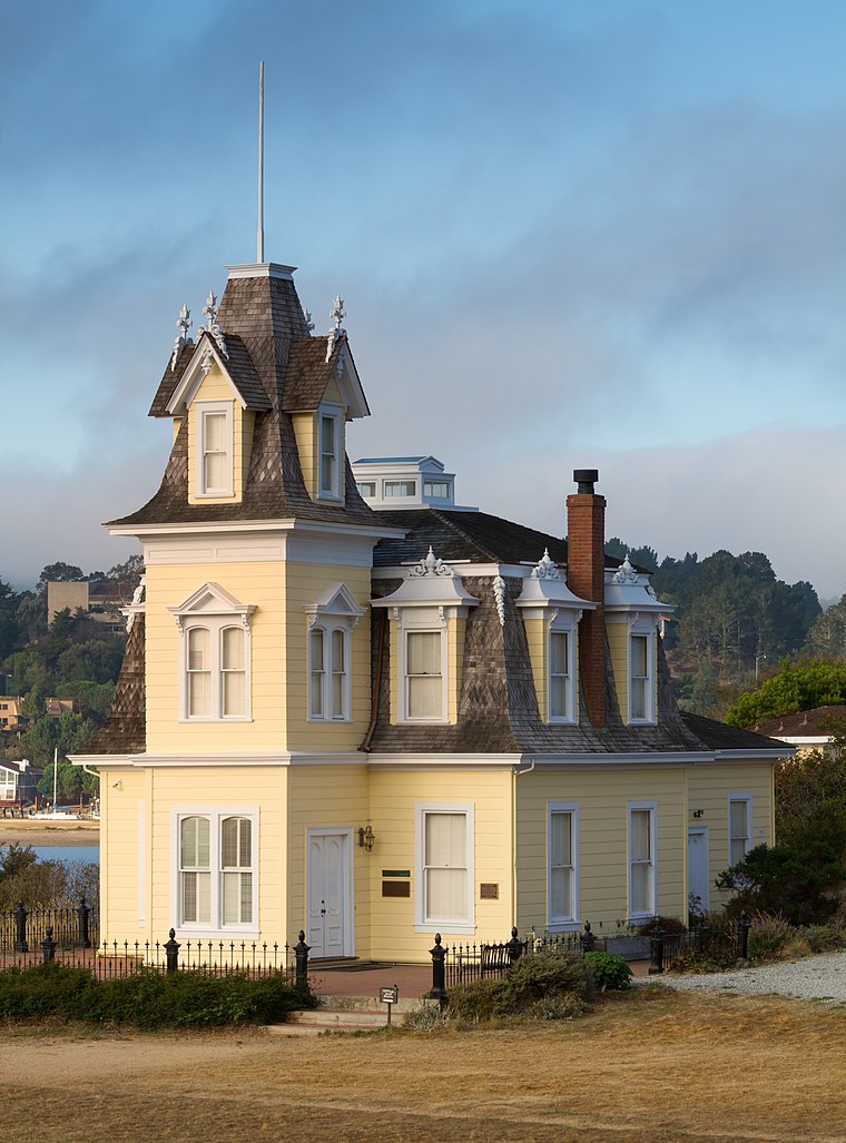
Photo: Wikimedia, CC BY-SA 3.0.
The Lyford House is a Victorian house located in Tiburon, California. Built in 1876, the house is listed on the National Register of Historic Places. Benjamin and Hilarita Lyford House is situated 2 miles south of Phyllis Ellman Trailhead Parking.
Places in the Area
Nearby places include Paradise Cay and Bel Aire.
Paradise Cay
Hamlet

Photo: Frank Schulenburg, CC BY-SA 4.0.
Paradise Cay, also known as County Service Area No. 29, is an unincorporated enclave, surrounded by the town of Tiburon in Marin County, California, United States, located 2 miles south of Point San Quentin at an elevation of 23 feet.
Bel Aire
Hamlet
Bel Aire is a former unincorporated community, now incorporated in Tiburon in Marin County, California. It lies at an elevation of 20 feet.
Chapman
Hamlet
East Pasadena is an unincorporated community and census-designated place in Los Angeles County, California, United States. The population was 6,021 at the 2020 census, down from 6,144 at the 2010 census. Chapman is situated 1½ miles west of Phyllis Ellman Trailhead Parking.
Phyllis Ellman Trailhead Parking
- Type: Parking area
- Category: transportation
- Location: Marin County, California, United States, North America
- View on OpenStreetMap
Latitude
37.92099° or 37° 55′ 16″ northLongitude
-122.4944° or 122° 29′ 40″ westOpen location code
849VWGC4+96OpenStreetMap ID
node 10951776955OpenStreetMap feature
amenity=parking
This page is based on OpenStreetMap, Wikidata, and Wikimedia Commons.
We’d love your help improving our open data sources. Thank you for contributing.
Satellite Map
Discover Phyllis Ellman Trailhead Parking from above in high-definition satellite imagery.
Notable Places Nearby
Highlights include Phyllis Ellman Trailhead and San Clemente Park.
Nearby Places
Explore places such as San Clemente School and Seawolf Pumping Station.
Marin County: Must-Visit Destinations
Delve into Tiburon, Sausalito, San Rafael, and Novato.
Curious Parking Areas to Discover
Uncover intriguing parking areas from every corner of the globe.
About Mapcarta. Data © OpenStreetMap contributors and available under the Open Database License". Text is available under the CC BY-SA 4.0 license, except for photos, directions, and the map. Photo: Sanfranman59, CC BY-SA 3.0.