Indische Lebensmittel Ceylin
Indische Lebensmittel Ceylin is a supermarket in Krefeld, Düsseldorf, North Rhine-Westphalia. Indische Lebensmittel Ceylin is situated nearby to the church Freie evangelische Gemeinde, as well as near the park Alexanderplatz.| Tap on a place to explore it |
Places of Interest Nearby
Highlights include Hauptbahnhof Krefeld and Kaiser Wilhelm Museum.
Hauptbahnhof Krefeld
Railway station

Photo: A.Savin, CC BY-SA 3.0.
Krefeld Hauptbahnhof is the largest station of the city of Krefeld in the German state of North Rhine-Westphalia. The double-track and electrified Duisburg-Ruhrort–Mönchengladbach railway and the Lower Left Rhine Railway cross at the station. Hauptbahnhof Krefeld is situated 400 metres east of Indische Lebensmittel Ceylin.
Kaiser Wilhelm Museum
Museum

Photo: Wikimedia, CC BY-SA 3.0.
Kaiser Wilhelm Museum is situated 590 metres northwest of Indische Lebensmittel Ceylin.
CinemaxX Krefeld
Movie theater
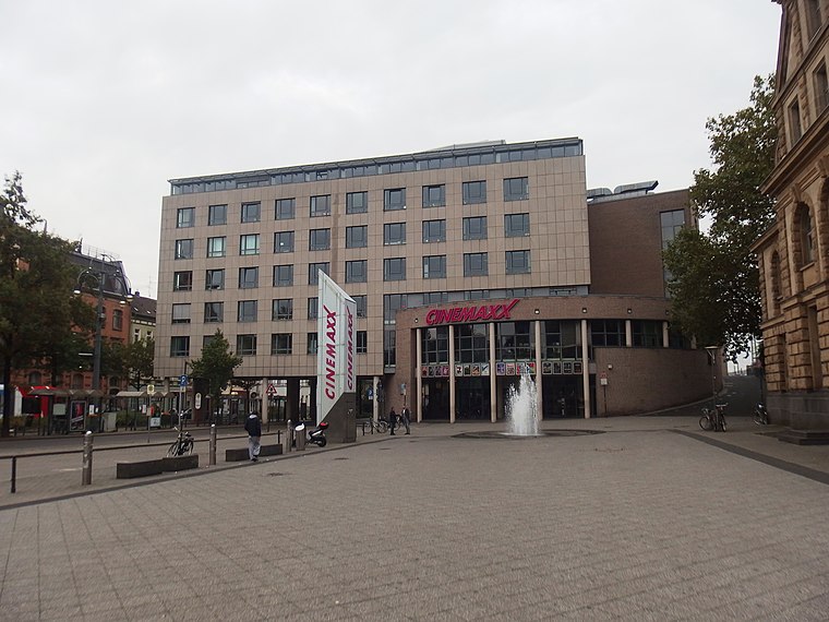
Photo: Palickap, CC BY-SA 4.0.
CinemaxX Krefeld is a movie theater, which is situated 500 metres east of Indische Lebensmittel Ceylin.
Places in the Area
Nearby places include Fischeln and Oppum.
Fischeln
Suburb

Photo: Ludger1961, CC BY-SA 3.0 de.
Fischeln is the most southerly district of Krefeld, Germany. Its population is 26,030 and its area is 18.99 km2. Older than Krefeld, Fischeln was first mentioned as "Viscolo" around 900AD. Fischeln is situated 3 km southeast of Indische Lebensmittel Ceylin.
Oppum
Suburb
Oppum is a quarter of Krefeld, a city in North Rhine-Westphalia, Germany. Oppum probably developed as a Frankish farmer settlement. Its existence was first documented in the year 1072. Oppum is situated 3½ km east of Indische Lebensmittel Ceylin.
Inrath
Suburb

Photo: Carschten, CC BY-SA 4.0.
Inrath is a suburb, which is situated 3½ km northwest of Indische Lebensmittel Ceylin.
Indische Lebensmittel Ceylin
- Type: Supermarket
- Categories: shop and food
- Location: Krefeld, Düsseldorf, Lower Rhine, North Rhine-Westphalia, Germany, Central Europe, Europe
- View on OpenStreetMap
Latitude
51.32577° or 51° 19′ 33″ northLongitude
6.5638° or 6° 33′ 50″ eastOpen location code
9F388HG7+8GOpenStreetMap ID
node 10977889338OpenStreetMap feature
shop=supermarket
This page is based on OpenStreetMap, Wikidata, and Wikimedia Commons.
We’d love your help improving our open data sources. Thank you for contributing.
Satellite Map
Discover Indische Lebensmittel Ceylin from above in high-definition satellite imagery.
Notable Places Nearby
Highlights include Freie evangelische Gemeinde and Alexanderplatz.
Nearby Places
Explore places such as Cafe Balkanika and Dostlar Friseur.
Lower Rhine: Must-Visit Destinations
Delve into Düsseldorf, Mönchengladbach, Neuss, and Kleve.
Curious Supermarkets to Discover
Uncover intriguing supermarkets from every corner of the globe.
About Mapcarta. Data © OpenStreetMap contributors and available under the Open Database License". Text is available under the CC BY-SA 4.0 license, except for photos, directions, and the map. Photo: Carschten, CC BY-SA 4.0.