Bodega Bay Equestrian Trailhead
Bodega Bay Equestrian Trailhead is in Sonoma County, California. Bodega Bay Equestrian Trailhead is situated nearby to the disaster remains SS Marin, as well as near Porto Bodega Marina.| Tap on a place to explore it |
Places of Interest Nearby
Highlights include Bodega Head.
Bodega Head
Peak
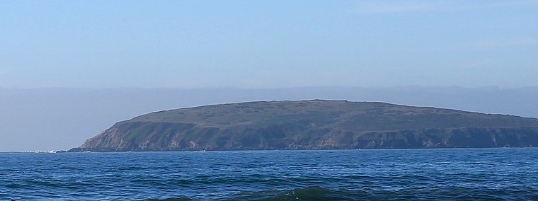
Photo: Stepheng3, CC BY-SA 3.0.
Bodega Head is a small promontory on the Pacific coast of northern California in the United States. It is located in Sonoma County, approximately 40 mi northwest of San Francisco and approximately 20 mi west of Santa Rosa. Bodega Head is situated 2 miles south of Bodega Bay Equestrian Trailhead.
Places in the Area
Nearby places include Bodega Bay and Carmet.
Bodega Bay
 Bodega Bay is an ocean-front town of 900 people in Sonoma County in California. It was the location for the filming of much of Alfred Hitchcock's horror film The Birds.
Carmet
Village
 Carmet is a census-designated place in Sonoma County, California. Carmet sits at an elevation of 180 feet. The 2020 United States census reported Carmet's population was 55. Carmet is situated 3 miles northwest of Bodega Bay Equestrian Trailhead.
Bodega Bay Equestrian Trailhead
- Type: Sign
- Categories: information and tourism
- Location: Sonoma County, California, United States, North America
- View on OpenStreetMap
Latitude
38.33552° or 38° 20′ 8″ northLongitude
-123.05569° or 123° 3′ 21″ westOpen location code
84CR8WPV+6POpenStreetMap ID
node 10982145280OpenStreetMap feature
tourism=information
This page is based on OpenStreetMap, Wikidata, and Wikimedia Commons.
We’d love your help improving our open data sources. Thank you for contributing.
Satellite Map
Discover Bodega Bay Equestrian Trailhead from above in high-definition satellite imagery.
Notable Places Nearby
Highlights include SS Marin and Porto Bodega Marina.
Nearby Places
Explore places such as Reception and Anello Family Crab & Seafood.
Sonoma County: Must-Visit Destinations
Delve into Santa Rosa, Petaluma, Sonoma, and Healdsburg.
Curious Places to Discover
Uncover intriguing places from every corner of the globe.
About Mapcarta. Data © OpenStreetMap contributors and available under the Open Database License". Text is available under the CC BY-SA 4.0 license, except for photos, directions, and the map. Photo: Wikimedia, CC0.