Our Mammal Friends
Our Mammal Friends is in County Meath, Leinster. Our Mammal Friends is situated nearby to Zip Wire, as well as near Saint Oliver Plunkett’s Church and Tower House.| Tap on a place to explore it |
Places of Interest Nearby
Highlights include Loughcrew and Slieve na Calliagh.
Loughcrew
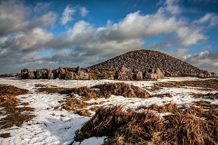
Photo: Haydn.hammerton, CC BY-SA 4.0.
Loughcrew or Lough Crew is an area of historical importance near Oldcastle, County Meath, Ireland. It is home to a group of ancient tombs from the 4th millennium BC, some decorated with rare megalithic art, which sit on top of a range of hills. Loughcrew is situated 2½ km northeast of Our Mammal Friends.
Slieve na Calliagh
Peak

Photo: Bill Griffiths, CC BY-SA 2.0.
Slieve na Calliagh are a range of hills and ancient burial site near Oldcastle, County Meath, Ireland. The summit is 276 metres, the highest point in the county. Slieve na Calliagh is situated 2½ km northeast of Our Mammal Friends.
Places in the Area
Nearby places include Drumone and Oldcastle.
Drumone
Locality

Photo: Eric Jones, CC BY-SA 2.0.
Drumone is a small village and townland in western County Meath, Ireland. The local Roman Catholic church is dedicated to St. Mary and was built in 1834. A nearby disused Gaelic handball court dates to c.1920. The local GAA club is Moylagh GAA.
Oldcastle
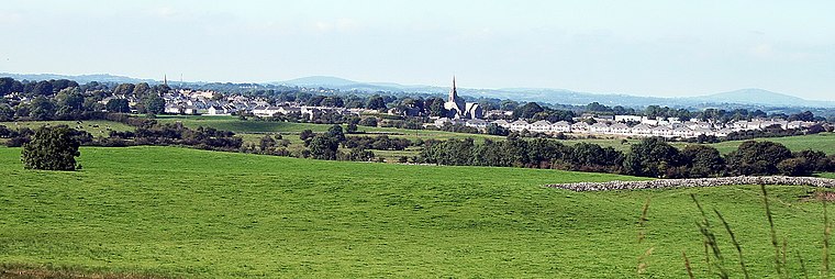
Photo: Sarah777, Public domain.
Oldcastle is a town in County Meath in central Ireland, with a population in 2022 of 1400. The reason to visit is the collection of prehistoric tombs at Loughcrew Cairns, which are as fine as those at better-known Newgrange but even older, and without the tourist hordes.
Fore
Village

Photo: Wikimedia, CC BY-SA 3.0.
Fore is a village, next to the old Benedictine Abbey ruin of Fore Abbey, situated to the north of Lough Lene in County Westmeath, in Ireland. The village, is situated within a valley between two hills: the Hill of Ben, the Hill of Houndslow, and the Ankerland rise area. Fore is situated 8 km southwest of Our Mammal Friends.
Our Mammal Friends
- Type: Sign
- Categories: information and tourism
- Location: County Meath, Leinster, East Coast and Midlands, Ireland, Britain and Ireland, Europe
- View on OpenStreetMap
Latitude
53.73167° or 53° 43′ 54″ northLongitude
-7.14579° or 7° 8′ 45″ westOpen location code
9C5JPVJ3+MMOpenStreetMap ID
node 11006343880OpenStreetMap feature
tourism=information
This page is based on OpenStreetMap, Wikidata, and Wikimedia Commons.
We’d love your help improving our open data sources. Thank you for contributing.
Satellite Map
Discover Our Mammal Friends from above in high-definition satellite imagery.
Notable Places Nearby
Highlights include Zip Wire and Saint Oliver Plunkett’s Church and Tower House.
Nearby Places
Explore places such as The Yew Walk and Alice in Wonderland.
County Meath: Must-Visit Destinations
Delve into Navan, Brú Na Bóinne Archaeological Park, Kells, and Trim.
Curious Places to Discover
Uncover intriguing places from every corner of the globe.
About Mapcarta. Data © OpenStreetMap contributors and available under the Open Database License". Text is available under the CC BY-SA 4.0 license, except for photos, directions, and the map. Photo: Guenni, CC BY-SA 3.0.