Urbanización el Pendón
Urbanización el Pendón is a neighborhood in Carranque, Toledo, Castile-La Mancha. Urbanización el Pendón is situated nearby to the neighborhood Pendón Pradillo Topo, as well as near El Llano.| Tap on a place to explore it |
Places of Interest
Highlights include Serranillos del Valle town hall and Church of San Andrés Apóstol.
Church of San Andrés Apóstol
Church
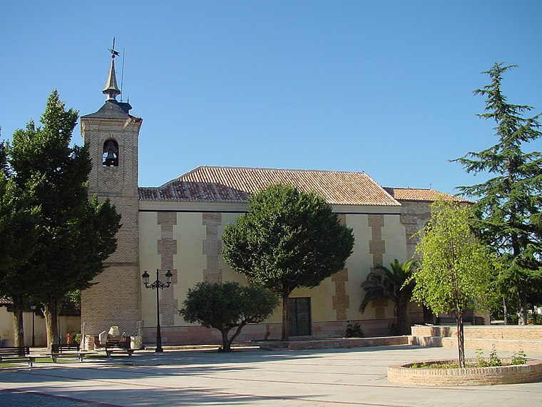
Photo: Wikimedia, CC BY 3.0 es.
The Church of San Andrés Apóstol is a church located in Cubas de la Sagra, Spain. It was declared Bien de Interés Cultural in 1983. Church of San Andrés Apóstol is situated 3½ km east of Urbanización el Pendón.
Places in the Area
Nearby places include Serranillos del Valle and Ugena.
Serranillos del Valle
Village

Photo: Wikimedia, CC BY 3.0 es.
Serranillos del Valle is a municipality of the Community of Madrid, Spain. In 2022 it had a population of 4,509.
Ugena
Village

Photo: Malopez 21, CC BY-SA 4.0.
Ugena is a municipality located in the province of Toledo, Castile-La Mancha, Spain. According to the 2006 census, the municipality has a population of 3,942 inhabitants. Ugena is situated 3 km south of Urbanización el Pendón.
Cubas de la Sagra
Village
 Cubas de la Sagra is a municipality of the autonomous community of Madrid in central Spain. It belongs to the natural comarca of La Sagra. The Church of San Andrés Apóstol stands in the town. Cubas de la Sagra is situated 3½ km east of Urbanización el Pendón.
Urbanización el Pendón
- Type: Neighborhood
- Category: locality
- Location: Carranque, Toledo, Castile-La Mancha, Central Spain, Spain, Iberia, Europe
- View on OpenStreetMap
Latitude
40.18351° or 40° 11′ 1″ northLongitude
-3.87924° or 3° 52′ 45″ westElevation
670 metres (2,198 feet)Open location code
8CGR54MC+C8OpenStreetMap ID
node 11011013804OpenStreetMap feature
place=neighbourhood
This page is based on OpenStreetMap, Wikidata, and Wikimedia Commons.
We’d love your help improving our open data sources. Thank you for contributing.
Satellite Map
Discover Urbanización el Pendón from above in high-definition satellite imagery.
Localities in the Area
Explore places such as Pendón Pradillo Topo and El Llano.
Notable Places Nearby
Highlights include Parque Camino Cebadero and El Pinar.
Castile-La Mancha: Must-Visit Destinations
Delve into Toledo, Albacete, Cuenca, and Ciudad Real.
Curious Neighborhoods to Discover
Uncover intriguing neighborhoods from every corner of the globe.
About Mapcarta. Data © OpenStreetMap contributors and available under the Open Database License". Text is available under the CC BY-SA 4.0 license, except for photos, directions, and the map. Photo: Diliff, CC BY-SA 3.0.