Van Buren Street
Van Buren Street is a railway stop in Chicago, Cook, Illinois. Van Buren Street is situated nearby to Jackson Bridge, as well as near the work of art Bust of Georg Solti.| Tap on a place to explore it |
Places of Interest Nearby
Highlights include Chicago "L" and Millennium Park.
Chicago "L"

Photo: lazytom, CC BY-SA 2.0.
The Chicago "L" is the rapid transit system serving the city of Chicago and some of its surrounding suburbs in the U.S. state of Illinois. Operated by the Chicago Transit Authority, it is the fourth-largest rapid transit system in the United States in terms… Chicago "L" is situated 890 feet west of Van Buren Street.
Millennium Park
Park
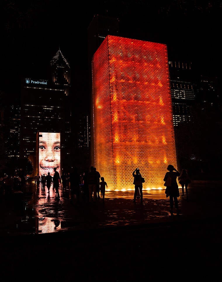
Photo: Alhill42, CC BY-SA 4.0.
Millennium Park is a public park in the Loop community area of Chicago, Illinois, United States, operated by the Chicago Department of Cultural Affairs.
Van Buren Street station
Railway station

Photo: Richie Diesterheft, CC BY 2.0.
Van Buren Street station is a commuter rail station in downtown Chicago that serves the Metra Electric Line to University Park, Blue Island, and South Chicago neighborhood; and the South Shore Line to Gary and South Bend, Indiana. Van Buren Street station is situated 400 feet south of Van Buren Street.
Places in the Area
Nearby places include Jewelers Row District and Loop.
Jewelers Row District
Neighborhood
The Jewelers Row District is a historic district in the Loop community area of Chicago, Illinois in the United States. Running along Wabash Avenue, primarily between East Washington Street and East Monroe Street, the buildings in the district were built…
Loop

Photo: Poco a poco, CC BY-SA 3.0.
The Loop is the central business district of Chicago, bounded by the Chicago River to the north and west, Harrison Street to the south, and Lake Michigan to the east.
Printer’s Row
Neighborhood

Photo: puroticorico, CC BY 2.0.
Printers Row, also known as Printing House Row, is a Chicago neighborhood located in South Loop. The area of Printers Row is generally defined by Ida B.
Van Buren Street
- Type: Railway stop
- Categories: transport stop and transportation
- Location: Chicago, Cook, Chicagoland, Illinois, Midwest, United States, North America
- View on OpenStreetMap
Latitude
41.87802° or 41° 52′ 41″ northLongitude
-87.62292° or 87° 37′ 23″ westOperator
MetraNetwork
Metra;NICTDOpen location code
86HJV9HG+6ROpenStreetMap ID
node 1105878913OpenStreetMap feature
public_transport=stop_positionOpenStreetMap feature
railway=stop
This page is based on OpenStreetMap, Wikidata, and Wikimedia Commons.
We’d love your help improving our open data sources. Thank you for contributing.
Satellite Map
Discover Van Buren Street from above in high-definition satellite imagery.
Places with the Same Name
Discover other places named “Van Buren Street”.
Notable Places Nearby
Highlights include Jackson Bridge and Bust of Georg Solti.
Nearby Places
Explore places such as Van Buren Street and Grant Park South Garage.
Chicago: Must-Visit Destinations
Delve into Loop, Near North, O’Hare International Airport, and Hyde Park.
Curious Railway Stops to Discover
Uncover intriguing railway stops from every corner of the globe.
About Mapcarta. Data © OpenStreetMap contributors and available under the Open Database License". Text is available under the CC BY-SA 4.0 license, except for photos, directions, and the map. Photo: Raymonst, CC BY-SA 3.0.